|
search place name
|
||
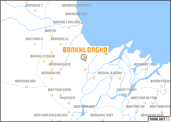
Ban Khlong Ko (Surat Thani, Thailand)Ban Khlong Ko is a town in the Surat Thani region of Thailand. An overview map of the region around Ban Khlong Ko is displayed below.
regional and 3d topo map of Ban Khlong Ko, Thailand ::
Ban Khlong Ko airports ::
The nearest airport is NST - Nakhon Si Thammarat Cha Ian, located 113.2 km south east of Ban Khlong Ko.
Other airports nearby include HKT - Phuket Intl (156.9 km south west), TST - Trang (191.8 km south), Nearby towns ::
Ban Bang Yai (1.9km south) //
Ban Bang Pho (4.1km south east) //
Ban Don Yai (5.8km west) //
Ban Phai Phra (5.8km west) //
Ban Khlong Noi (6.6km south east) //
Ban Nong Si (6.6km north west) //
Ban Don Riap (7.3km west) //
Ban Khlong Ho (7.5km west) //
Ban Maruan (7.5km west) //
Ban Hua Han (8.2km south west) //
Ban Khlong Duang (8.2km south east) //
Amphoe Tha Chang (8.3km north west) //
Ban Yai (9.2km north west) //
Ban Thung Pho (9.2km south west) //
Ban Don Rak (10.4km south west) //
Ban Hua Toei (10.4km south west) //
[all distances 'as the bird flies' and approximate] 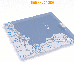 Places with similar names to Ban Khlong Ko, Thailand ::
// Ban Khlong Ka (TH)
// Ban Khlong Kaeo (TH)
// Ban Khlong Kao (TH)
// Ban Khlong Kao (TH)
// Ban Khlong Kao (TH)
// Ban Khlong Kua (TH)
// Ban Khlong Kua (TH)
// Ban Klang (2) (TH)
// Ban Klang (2) (TH)
Disclaimer :: Information on this page comes without warranty of any kind |
||
|
Where is Ban Khlong Ko? Elevation and coordinates ::
Latitude (lat): 9°12'0"N Longitude (lon): 99°14'0"E
Elevation (approx.): 6m (map arrows pan, magnifying glasses zoom) |
||
|
Visiting Ban Khlong Ko? Hotel/Accommodation ::
Book a hotel in Ban Khlong Ko Travel Guide ::
Buy a travel guide for Thailand rental cars ::
car rental offers GPS waypoint ::
download a GPX waypoint (PoI) of Ban Khlong Ko for your GPS receiver
|
||