|
search place name
|
||
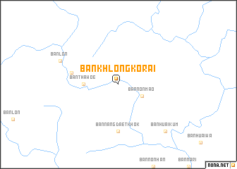
Ban Khlong Ko Rai (Chaiyaphum, Thailand)Ban Khlong Ko Rai is a town in the Chaiyaphum region of Thailand. An overview map of the region around Ban Khlong Ko Rai is displayed below.
regional and 3d topo map of Ban Khlong Ko Rai, Thailand ::
Ban Khlong Ko Rai airports ::
The nearest airport is LOE - Loei, located 136.3 km north of Ban Khlong Ko Rai.
Other airports nearby include PHS - Phitsanulok (151.1 km north west), NAK - Nakhon Ratchasima Khorat (152.1 km south), UTH - Udon Thani (183.6 km north east), VTE - Vientiane Wattay Intl (222.9 km north east), Nearby towns ::
Ban Non Mao (4.0km south east) //
Ban Tha Woe (5.3km west) //
Ban Nang Daet Khok (7.4km south) //
Ban Huai Kata (7.4km west) //
Ban Huai Kum (10.3km south east) //
[all distances 'as the bird flies' and approximate] 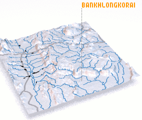 Places with similar names to Ban Khlong Ko Rai, Thailand ::
// Ban Khlong Khrai (TH)
Disclaimer :: Information on this page comes without warranty of any kind |
||
|
Where is Ban Khlong Ko Rai? Elevation and coordinates ::
Latitude (lat): 16°13'0"N Longitude (lon): 101°34'0"E
Elevation (approx.): 270m (map arrows pan, magnifying glasses zoom) |
||
|
Visiting Ban Khlong Ko Rai? Hotel/Accommodation ::
Book a hotel in Ban Khlong Ko Rai Travel Guide ::
Buy a travel guide for Thailand rental cars ::
car rental offers GPS waypoint ::
download a GPX waypoint (PoI) of Ban Khlong Ko Rai for your GPS receiver
|
||