|
search place name
|
||
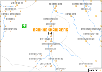
Ban Khok Mai Daeng (Nakhon Ratchasima, Thailand)Ban Khok Mai Daeng is a town in the Nakhon Ratchasima region of Thailand. An overview map of the region around Ban Khok Mai Daeng is displayed below.
regional and 3d topo map of Ban Khok Mai Daeng, Thailand ::
Ban Khok Mai Daeng airports ::
The nearest airport is NAK - Nakhon Ratchasima Khorat, located 34.6 km west of Ban Khok Mai Daeng.
Other airports nearby include BKK - Bangkok Intl (223.0 km south west), REP - Siem-reap Siem Reap (225.9 km south east), Nearby towns ::
Ban Krok Mai Daeng (0.0km north) //
Ban Si Suk (1.9km south) //
Ban La Ko (2.6km south west) //
Ban Ta Ngoen (2.6km south west) //
Ban Lako (1) (3.7km north) //
Ban Khok Nong Sano (3.7km south) //
Ban Chong Kho (1) (5.6km north) //
Ban Wang Wa (5.6km south) //
Ban Hin Mongkhon (8.2km south west) //
Ban Nong Phai (9.2km south west) //
Ban Don Man (10.3km north east) //
[all distances 'as the bird flies' and approximate]  Places with similar names to Ban Khok Mai Daeng, Thailand ::
Disclaimer :: Information on this page comes without warranty of any kind |
||
|
Where is Ban Khok Mai Daeng? Elevation and coordinates ::
Latitude (lat): 14°55'0"N Longitude (lon): 102°24'0"E
Elevation (approx.): 192m (map arrows pan, magnifying glasses zoom) |
||
|
Visiting Ban Khok Mai Daeng? Hotel/Accommodation ::
Book a hotel in Ban Khok Mai Daeng Travel Guide ::
Buy a travel guide for Thailand rental cars ::
car rental offers GPS waypoint ::
download a GPX waypoint (PoI) of Ban Khok Mai Daeng for your GPS receiver
|
||