|
search place name
|
||
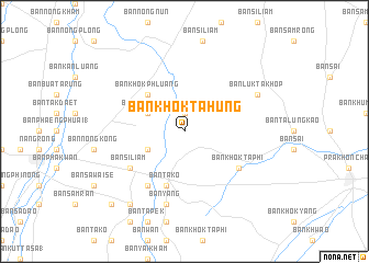
Ban Khok Ta Hung (Buriram, Thailand)Ban Khok Ta Hung is a town in the Buriram region of Thailand. An overview map of the region around Ban Khok Ta Hung is displayed below.
regional and 3d topo map of Ban Khok Ta Hung, Thailand ::
Ban Khok Ta Hung airports ::
The nearest airport is NAK - Nakhon Ratchasima Khorat, located 97.2 km west of Ban Khok Ta Hung.
Other airports nearby include REP - Siem-reap Siem Reap (166.8 km south east), ZVK - Savannakhet (287.9 km north east), UTP - Rayong U Taphao Intl (301.7 km south west), Nearby towns ::
Ban Khwao (1.9km north) //
Ban Khok Sa-nuan (4.0km south west) //
Ban Nong Kong (4.0km north west) //
Ban Khok Phluang (5.2km north west) //
Ban Ta Ko (5.8km south) //
Ban Ra Boet (6.6km south west) //
Ban Khok Ta Phi (6.5km south east) //
Ban Si Liam (6.5km south west) //
Ban Don Mai Fai (7.6km south) //
Ban Yang (7.6km south) //
Ban Luk Takhop (8.1km north east) //
Ban Nong Chok (9.2km south west) //
Ban Sa Kae (9.2km south west) //
Ban Nong Bon (10.3km south west) //
Ban Prada Cha-bok (10.3km south west) //
[all distances 'as the bird flies' and approximate] 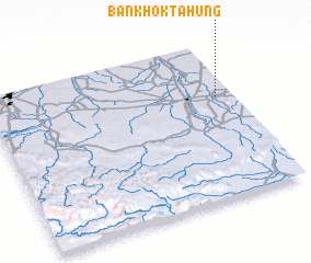 Places with similar names to Ban Khok Ta Hung, Thailand :: Disclaimer :: Information on this page comes without warranty of any kind |
||
|
Where is Ban Khok Ta Hung? Elevation and coordinates ::
Latitude (lat): 14°39'0"N Longitude (lon): 102°56'0"E
Elevation (approx.): 182m (map arrows pan, magnifying glasses zoom) |
||
|
Visiting Ban Khok Ta Hung? Hotel/Accommodation ::
Book a hotel in Ban Khok Ta Hung Travel Guide ::
Buy a travel guide for Thailand rental cars ::
car rental offers GPS waypoint ::
download a GPX waypoint (PoI) of Ban Khok Ta Hung for your GPS receiver
|
||