|
search place name
|
||
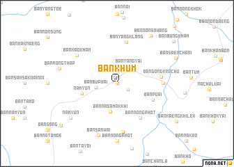
Ban Khum (Ubon Ratchathani, Thailand)Ban Khum is a town in the Ubon Ratchathani region of Thailand. An overview map of the region around Ban Khum is displayed below.
regional and 3d topo map of Ban Khum, Thailand ::
Ban Khum airports ::
The nearest airport is PKZ - Pakse, located 99.0 km north east of Ban Khum.
Other airports nearby include REP - Siem-reap Siem Reap (186.4 km south west), Nearby towns ::
Ban Ta Luak (0.0km north) //
Ban Kaeng Kho (0.0km north) //
Ban Kaeng Ton (2.0km south east) //
Ban Yang Yai (3.3km north east) //
Ban Bu Puai (3.3km west) //
Ban Na Samakkhi (4.6km south) //
Nam Yun (5.7km west) //
Ban Puai (6.2km south east) //
Ban Nong Phot (6.6km south east) //
Ban Yang Klang (6.8km north) //
Ban Dong Krachu (6.9km east) //
Ban Dong Kasu (7.2km east) //
Ban Dong Kasu (7.2km east) //
Ban Phon Thong (7.8km south) //
Ban Kao Kham (7.7km north west) //
Ban Sam Wai (8.8km south) //
Nam Yun (9.1km south west) //
Ban Non Sawang (9.2km north east) //
[all distances 'as the bird flies' and approximate] 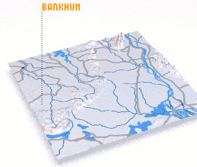 Places with similar names to Ban Khum, Thailand ::
// Ban Ai Khaem (TH)
// Ban Ao Kham (TH)
// Ban Ao Kham (TH)
// Ban Kahom (TH)
// Ban Khaem (TH)
// Ban Khaem (TH)
// Ban Khaem (TH)
// Ban Khaem (TH)
// Ban Kham (TH)
// Ban Kham (TH)
Disclaimer :: Information on this page comes without warranty of any kind |
||
|
Where is Ban Khum? Elevation and coordinates ::
Latitude (lat): 14°33'0"N Longitude (lon): 105°5'0"E
Elevation (approx.): 185m (map arrows pan, magnifying glasses zoom) |
||
|
Visiting Ban Khum? Hotel/Accommodation ::
Book a hotel in Ban Khum Travel Guide ::
Buy a travel guide for Thailand rental cars ::
car rental offers GPS waypoint ::
download a GPX waypoint (PoI) of Ban Khum for your GPS receiver
|
||