|
search place name
|
||
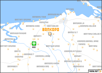
Ban Ko Po (Pattani, Thailand)Ban Ko Po is a town in the Pattani region of Thailand. An overview map of the region around Ban Ko Po is displayed below.
regional and 3d topo map of Ban Ko Po, Thailand ::
Ban Ko Po airports ::
The nearest airport is PAN - Pattani, located 6.7 km south west of Ban Ko Po.
Other airports nearby include NAW - Narathiwat (67.1 km south east), HDY - Songkhla Hat Yai Intl (91.3 km west), AOR - Alor Setar Sultan Abdul Halim (112.8 km south west), KBR - Kota Bahru Sultan Ismail Petra (139.3 km south east), Nearby towns ::
Kampong Kachino (1.2km north east) //
Ban Paka Chino (1.9km north west) //
Ban Tha Ku Bo (2.2km south) //
Kampong Koto (2.8km east) //
Ban Tha Dan (2.9km north) //
Ban Khok Dipli (3.0km west) //
Nong Chik (4.7km north west) //
Ban Thung Pho (4.7km south) //
Ban Ka Yi (4.8km west) //
Ban Phai Man (5.5km south west) //
Ban Don Yang (6.1km west) //
Changwat Pattani (6.6km south west) //
Ban Bang Tawa (6.6km south west) //
Amphoe Nong Chik (6.6km south west) //
Ban Bo Met Chun (6.6km west) //
Ban Pitu Mu (6.9km south east) //
Ban Bang Khao (7.1km north west) //
Ban Ru Sa Mi Lae (7.1km north) //
Ban Bang Ta Wa (7.4km north west) //
Ban Bra (7.6km east) //
Ban Rusamilae (7.9km north east) //
Ban Bo Thong (7.9km west) //
Ban Pu Yut (8.2km east) //
Ban Ba Ing (8.5km north west) //
Ban Pu Yuk (8.6km east) //
Kampong Baraho (8.6km east) //
Yanang (8.7km east) //
Kampong Lamae (8.8km south) //
Ban Chamao (9.3km south west) //
[all distances 'as the bird flies' and approximate] 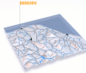 Places with similar names to Ban Ko Po, Thailand ::
// Bone Gap (US)
// Ban Kae Pe (TH)
// Ban Kapi (TH)
// Ban Kapo (TH)
// Ban Kapu (TH)
// Ban Kiap (TH)
// Ban Kip Pae (TH)
// Ban Ko Pao (TH)
// Ban Ko Po (TH)
// Ban Kup (TH)
Disclaimer :: Information on this page comes without warranty of any kind |
||
|
Where is Ban Ko Po? Elevation and coordinates ::
Latitude (lat): 6°48'31"N Longitude (lon): 101°12'33"E
Elevation (approx.): 11m (map arrows pan, magnifying glasses zoom) |
||
|
Visiting Ban Ko Po? Hotel/Accommodation ::
Book a hotel in Ban Ko Po Travel Guide ::
Buy a travel guide for Thailand rental cars ::
car rental offers GPS waypoint ::
download a GPX waypoint (PoI) of Ban Ko Po for your GPS receiver
|
||