|
search place name
|
||
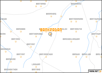
Ban Kradan (Surin, Thailand)Ban Kradan is a town in the Surin region of Thailand. An overview map of the region around Ban Kradan is displayed below.
regional and 3d topo map of Ban Kradan, Thailand ::
Ban Kradan airports ::
The nearest airport is REP - Siem-reap Siem Reap, located 154.2 km south of Ban Kradan.
Other airports nearby include NAK - Nakhon Ratchasima Khorat (175.1 km west), ZVK - Savannakhet (225.1 km north east), Nearby towns ::
Ban Trom Phrai (2.6km north west) //
Ban Priang (2.6km north west) //
Ban Nong Lek (4.0km north east) //
Ban Thap Kabu (5.4km west) //
Ban Priang (7.4km north) //
Ban Khok Lamduan (7.4km east) //
Ban Yang Chum (7.6km south) //
Ban Nong Pet (7.6km south) //
Ban Charaphat (8.2km north east) //
Ban Trat (8.1km south west) //
Ban Samrong (9.1km north east) //
[all distances 'as the bird flies' and approximate] 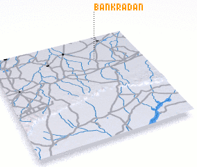 Places with similar names to Ban Kradan, Thailand ::
// Beingarten (DE)
// Biengarten (DE)
// Biengarten (DE)
// Bingarten (DE)
// Ban Kradon (TH)
// Ban Kradon Noi (TH)
// Ban Kra Ta Un (TH)
// Ban Kraten (TH)
// Bin Qirdān (TN)
// Bunkertown (US)
Disclaimer :: Information on this page comes without warranty of any kind |
||
|
Where is Ban Kradan? Elevation and coordinates ::
Latitude (lat): 14°48'0"N Longitude (lon): 103°42'0"E
Elevation (approx.): 154m (map arrows pan, magnifying glasses zoom) |
||
|
Visiting Ban Kradan? Hotel/Accommodation ::
Book a hotel in Ban Kradan Travel Guide ::
Buy a travel guide for Thailand rental cars ::
car rental offers GPS waypoint ::
download a GPX waypoint (PoI) of Ban Kradan for your GPS receiver
|
||