|
search place name
|
||
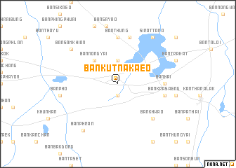
Ban Kut Na Kaeo (Sisaket, Thailand)Ban Kut Na Kaeo is a town in the Sisaket region of Thailand. An overview map of the region around Ban Kut Na Kaeo is displayed below.
regional and 3d topo map of Ban Kut Na Kaeo, Thailand ::
Ban Kut Na Kaeo airports ::
The nearest airport is PKZ - Pakse, located 143.8 km east of Ban Kut Na Kaeo.
Other airports nearby include REP - Siem-reap Siem Reap (159.3 km south west), ZVK - Savannakhet (210.5 km north), Nearby towns ::
Ban Non Sung (1.9km south) //
Ban Dun Noi (1.9km south) //
Ban Na (1.9km south) //
Ban Nong Hin (3.7km north) //
Ban Nong Yai (5.2km north west) //
Ban Thung (7.4km north) //
Ban Hai (7.2km east) //
Ban Na (7.6km north) //
Ban Krasaeng (7.4km east) //
Ban Khwao (7.7km south east) //
Ban Sam Khian (9.1km north west) //
Si Rattana (9.2km north east) //
Ban Phran (9.2km south west) //
[all distances 'as the bird flies' and approximate]  Places with similar names to Ban Kut Na Kaeo, Thailand ::
// Ban Ka Deng (TH)
// Ban Kaduang (TH)
// Ban Kaduang (TH)
// Ban Kadung (TH)
// Ban Ka Tong (TH)
// Ban Ko Daeng (TH)
// Ban Ko Daeng (TH)
// Ban Ku Daeng (TH)
// Ban Ku Tong (TH)
// Ban Ngao Tung (TH)
Disclaimer :: Information on this page comes without warranty of any kind |
||
|
Where is Ban Kut Na Kaeo? Elevation and coordinates ::
Latitude (lat): 14°40'0"N Longitude (lon): 104°32'0"E
Elevation (approx.): 149m (map arrows pan, magnifying glasses zoom) |
||
|
Visiting Ban Kut Na Kaeo? Hotel/Accommodation ::
Book a hotel in Ban Kut Na Kaeo Travel Guide ::
Buy a travel guide for Thailand rental cars ::
car rental offers GPS waypoint ::
download a GPX waypoint (PoI) of Ban Kut Na Kaeo for your GPS receiver
|
||