|
search place name
|
||
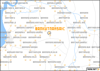
Ban Kut Nam Sai (2) (Chon Buri, Thailand)Ban Kut Nam Sai (2) is a town in the Chon Buri region of Thailand. An overview map of the region around Ban Kut Nam Sai (2) is displayed below.
regional and 3d topo map of Ban Kut Nam Sai (2), Thailand ::
Ban Kut Nam Sai (2) airports ::
The nearest airport is UTP - Rayong U Taphao Intl, located 79.1 km south of Ban Kut Nam Sai (2).
Other airports nearby include BKK - Bangkok Intl (81.7 km north west), HHQ - Prachuap Khiri Khan Hua Hin (152.5 km south west), NAK - Nakhon Ratchasima Khorat (199.7 km north east), Nearby towns ::
Ban Nong Muang Mai (0.0km north) //
Ban Pong Ta Muk (2.6km north west) //
Ban Huai Yang (3.6km west) //
Ban Nong Bon Daeng (4.1km south east) //
Ban Nong Hong (4.1km north west) //
Ban Nong Song Hong (4.1km south east) //
Ban Huai Map Pong (4.1km north west) //
Ban Nong Khayat (4.1km north east) //
Ban Nong Kasang (5.4km west) //
Ban Nong Chae Waen (5.6km north) //
Ban Map Phai (1) (5.7km west) //
Ban Mai (1) (5.8km north) //
Ban Soet (1) (5.8km north) //
Ban Kut Ngong (6.6km north east) //
Ban Nong Krathum (6.6km north west) //
Ban Nong Pla Lai (7.4km south) //
Ban Nong Kai (7.6km south) //
Ban Nong Tamlung (7.4km west) //
Ban Nong Faep (7.4km west) //
Ban Noen Matum (7.4km east) //
Ban Krarok (7.4km east) //
Ban Tha Pho (7.8km north east) //
Ban Nong Khlon (8.2km south west) //
Ban Huai Klang (8.1km south west) //
Ban Nong Khuk (8.2km south east) //
Ban Thung Na (9.2km south west) //
Ban Nong Din Daeng (9.1km north west) //
Ban Nong Sam Sak (9.1km south west) //
Ban Nong Phangphuai (9.1km south west) //
[all distances 'as the bird flies' and approximate] 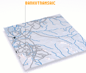 Places with similar names to Ban Kut Nam Sai (2), Thailand :: Disclaimer :: Information on this page comes without warranty of any kind |
||
|
Where is Ban Kut Nam Sai (2)? Elevation and coordinates ::
Latitude (lat): 13°23'0"N Longitude (lon): 101°8'0"E
Elevation (approx.): 21m (map arrows pan, magnifying glasses zoom) |
||
|
Visiting Ban Kut Nam Sai (2)? Hotel/Accommodation ::
Book a hotel in Ban Kut Nam Sai (2) Travel Guide ::
Buy a travel guide for Thailand rental cars ::
car rental offers GPS waypoint ::
download a GPX waypoint (PoI) of Ban Kut Nam Sai (2) for your GPS receiver
|
||