|
search place name
|
||
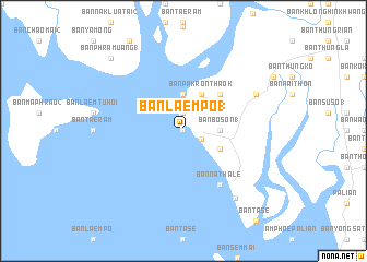
Ban Laem Po (1) (Trang, Thailand)Ban Laem Po (1) is a town in the Trang region of Thailand. An overview map of the region around Ban Laem Po (1) is displayed below.
regional and 3d topo map of Ban Laem Po (1), Thailand ::
Ban Laem Po (1) airports ::
The nearest airport is TST - Trang, located 31.8 km north of Ban Laem Po (1).
Other airports nearby include HDY - Songkhla Hat Yai Intl (100.6 km east), LGK - Pulau Langkawi Intl (102.2 km south), NST - Nakhon Si Thammarat Cha Ian (144.6 km north), AOR - Alor Setar Sultan Abdul Halim (149.9 km south east), Nearby towns ::
Ban Nai Khao (0.0km north) //
Ban Bawi (0.0km north) //
Ban Pratu Khao (1.9km north) //
Ban Khok Na (2.0km south east) //
Ban Bon Kai (1) (3.7km north) //
Ban Bo Son (1) (3.7km east) //
Ban Paron (3.9km north east) //
Ban Nong Wiwat (4.1km south east) //
Ban Datu (4.1km south east) //
Ban Pak Ron Tha Ok (4.1km north east) //
Ban Khuan Yang (1) (5.2km north east) //
Ban Na Thale (6.7km south east) //
Ban Bawi (8.2km north east) //
Ban Thung Pleo (8.7km south east) //
Ban Phra Muang (1) (10.4km north west) //
[all distances 'as the bird flies' and approximate] 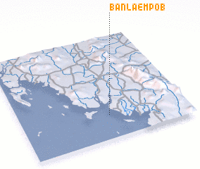 Places with similar names to Ban Laem Po (1), Thailand :: Disclaimer :: Information on this page comes without warranty of any kind |
||
|
Where is Ban Laem Po (1)? Elevation and coordinates ::
Latitude (lat): 7°14'0"N Longitude (lon): 99°32'0"E
Elevation (approx.): -32768m (map arrows pan, magnifying glasses zoom) |
||
|
Visiting Ban Laem Po (1)? Hotel/Accommodation ::
Book a hotel in Ban Laem Po (1) Travel Guide ::
Buy a travel guide for Thailand rental cars ::
car rental offers GPS waypoint ::
download a GPX waypoint (PoI) of Ban Laem Po (1) for your GPS receiver
|
||