|
search place name
|
||
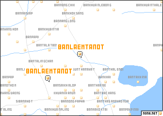
Ban Laem Tanot (Phatthalung, Thailand)Ban Laem Tanot is a town in the Phatthalung region of Thailand. An overview map of the region around Ban Laem Tanot is displayed below.
regional and 3d topo map of Ban Laem Tanot, Thailand ::
Ban Laem Tanot airports ::
The nearest airport is TST - Trang, located 58.7 km south west of Ban Laem Tanot.
Other airports nearby include NST - Nakhon Si Thammarat Cha Ian (73.1 km north), HDY - Songkhla Hat Yai Intl (104.8 km south), PAN - Pattani (166.9 km south east), LGK - Pulau Langkawi Intl (168.2 km south), Nearby towns ::
Ban Pan Tae (1) (1.9km south) //
Ban Suntharawat (3.7km south) //
Ban Samnak Ko (4.1km south west) //
Ban Suan Sa (4.1km south west) //
Ban Sai Sathon (7.4km south) //
Ban Talat Bo Sai (7.6km west) //
Ban Khuan Nut (7.6km south) //
Ban Khai (7.8km south east) //
Ban Nang Long (8.3km north west) //
Ban Sai Khalop (8.3km south west) //
Ban Tha Nae (8.3km south east) //
Ban Thale Noi (8.2km south east) //
Ban Laem Tanot (9.2km south west) //
Ban Khuan Tia (9.2km north west) //
Ban Khuan Phanang Tung (1) (9.2km south east) //
Ban Khuan Khreng (9.2km north west) //
Ban Chok Don (9.2km north west) //
[all distances 'as the bird flies' and approximate]  Places with similar names to Ban Laem Tanot, Thailand ::
// Ban Laem Tanot (TH)
Disclaimer :: Information on this page comes without warranty of any kind |
||
|
Where is Ban Laem Tanot? Elevation and coordinates ::
Latitude (lat): 7°49'0"N Longitude (lon): 100°3'0"E
Elevation (approx.): 3m (map arrows pan, magnifying glasses zoom) |
||
|
Visiting Ban Laem Tanot? Hotel/Accommodation ::
Book a hotel in Ban Laem Tanot Travel Guide ::
Buy a travel guide for Thailand rental cars ::
car rental offers GPS waypoint ::
download a GPX waypoint (PoI) of Ban Laem Tanot for your GPS receiver
|
||