|
search place name
|
||
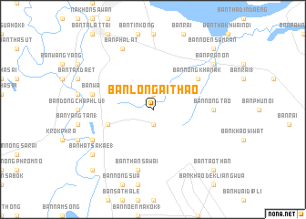
Ban Long Ai Thao (Nakhon Sawan, Thailand)Ban Long Ai Thao is a town in the Nakhon Sawan region of Thailand. An overview map of the region around Ban Long Ai Thao is displayed below.
regional and 3d topo map of Ban Long Ai Thao, Thailand ::
Ban Long Ai Thao airports ::
The nearest airport is PHS - Phitsanulok, located 133.1 km north of Ban Long Ai Thao.
Other airports nearby include BKK - Bangkok Intl (190.4 km south), NAK - Nakhon Ratchasima Khorat (215.9 km east), LOE - Loei (263.0 km north east), Nearby towns ::
Ban Pa Bua Thong (1.9km south) //
Ban Hua Thanon (1.9km south) //
Ban Khao Thong (1.9km south) //
Ban Mai (1.9km south) //
Ban Than Tabong (1.9km north) //
Ban Thung Ai Kok (5.7km west) //
Ban Nong Khanak (6.5km north east) //
Ban Nong Tao (7.1km east) //
Ban Than Sawai (7.6km south) //
Ban Wa (7.4km west) //
Ban Ta Niu (8.0km south west) //
Ban Pha Lat (8.2km north west) //
Ban Hat Sakae (1) (9.1km south west) //
Ban Pra Non (9.0km north east) //
Ban Bang Prap (1) (10.3km south west) //
Ban Tao Than (10.3km south east) //
Ban Hua Dong Phra Non (1) (10.3km north east) //
Ban Noen Samran (10.3km north east) //
[all distances 'as the bird flies' and approximate] 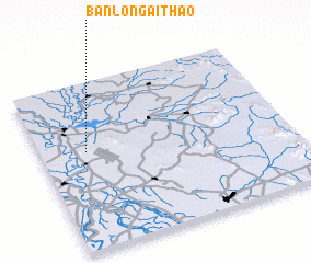 Places with similar names to Ban Long Ai Thao, Thailand :: Disclaimer :: Information on this page comes without warranty of any kind |
||
|
Where is Ban Long Ai Thao? Elevation and coordinates ::
Latitude (lat): 15°35'0"N Longitude (lon): 100°11'0"E
Elevation (approx.): 56m (map arrows pan, magnifying glasses zoom) |
||
|
Visiting Ban Long Ai Thao? Hotel/Accommodation ::
Book a hotel in Ban Long Ai Thao Travel Guide ::
Buy a travel guide for Thailand rental cars ::
car rental offers GPS waypoint ::
download a GPX waypoint (PoI) of Ban Long Ai Thao for your GPS receiver
|
||