|
search place name
|
||
Ban Mae La Ngio (Mae Hong Son, Thailand)Ban Mae La Ngio is a town in the Mae Hong Son region of Thailand. An overview map of the region around Ban Mae La Ngio is displayed below.
regional and 3d topo map of Ban Mae La Ngio, Thailand ::

Ban Mae La Ngio airports ::
The nearest airport is LPT - Lampang, located 175.0 km east of Ban Mae La Ngio.
Other airports nearby include RGN - Yangon Intl (247.8 km south west), Nearby towns ::
Ban Mae Lamong Tai (2.8km east) //
Ban Mae Lamong Nuea (4.8km north) //
Ban Khun Mae Laep (4.9km south) //
Ban Mae Laep (5.1km south east) //
Ban Mae Sampheng Tai (5.4km north east) //
Ban Huai Ko Pa (7.1km north) //
Ban Wang Khan (6.8km south east) //
Ban Thung Pa Kha (7.7km north east) //
Ban Mae Su (8.4km north east) //
Ban Suk Chai (8.4km north east) //
Ban Khun Mae Loe (8.3km south west) //
Ban Thong Phrasa (8.5km south east) //
Ban Mae La Noi (9.4km south east) //
[all distances 'as the bird flies' and approximate] 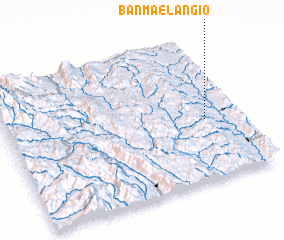 Places with similar names to Ban Mae La Ngio, Thailand :: Disclaimer :: Information on this page comes without warranty of any kind |
||
|
Where is Ban Mae La Ngio? Elevation and coordinates ::
Latitude (lat): 18°25'11"N Longitude (lon): 97°51'21"E
Elevation (approx.): 385m (map arrows pan, magnifying glasses zoom) |
||
|
Visiting Ban Mae La Ngio? Hotel/Accommodation ::
Book a hotel in Ban Mae La Ngio Travel Guide ::
Buy a travel guide for Thailand rental cars ::
car rental offers GPS waypoint ::
download a GPX waypoint (PoI) of Ban Mae La Ngio for your GPS receiver
|
||