|
search place name
|
||
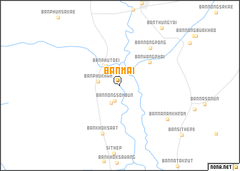
Ban Mai (Phetchabun, Thailand)Ban Mai is a town in the Phetchabun region of Thailand. An overview map of the region around Ban Mai is displayed below.
regional and 3d topo map of Ban Mai, Thailand ::
Ban Mai airports ::
The nearest airport is NAK - Nakhon Ratchasima Khorat, located 126.5 km south east of Ban Mai.
Other airports nearby include PHS - Phitsanulok (161.8 km north west), BKK - Bangkok Intl (187.5 km south), LOE - Loei (220.7 km north), UTH - Udon Thani (273.6 km north east), Nearby towns ::
Ban Nong Sombun (2.6km south) //
Ban Nong Teng (3.0km south west) //
Ban Phu Kham (3.4km west) //
Ban Phu Toei (3.8km north west) //
Ban Wang Phai (5.8km north east) //
Ban Nong Pong (7.4km north east) //
Ban Khok Sa-at (8.0km south) //
Ban Na Nam Khrom (8.9km south east) //
[all distances 'as the bird flies' and approximate]  Places with similar names to Ban Mai, Thailand ::
Disclaimer :: Information on this page comes without warranty of any kind |
||
|
Where is Ban Mai? Elevation and coordinates ::
Latitude (lat): 15°32'34"N Longitude (lon): 101°4'53"E
Elevation (approx.): 62m (map arrows pan, magnifying glasses zoom) |
||
|
Visiting Ban Mai? Hotel/Accommodation ::
Book a hotel in Ban Mai Travel Guide ::
Buy a travel guide for Thailand rental cars ::
car rental offers GPS waypoint ::
download a GPX waypoint (PoI) of Ban Mai for your GPS receiver
|
||