|
search place name
|
||
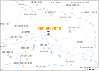
Ban Makyang (Roi Et, Thailand)Ban Makyang is a town in the Roi Et region of Thailand. An overview map of the region around Ban Makyang is displayed below.
regional and 3d topo map of Ban Makyang, Thailand ::
Ban Makyang airports ::
The nearest airport is ZVK - Savannakhet, located 151.2 km north east of Ban Makyang.
Other airports nearby include SNO - Sakon Nakhon (192.8 km north), PKZ - Pakse (204.2 km east), NAK - Nakhon Ratchasima Khorat (205.4 km west), UTH - Udon Thani (244.1 km north west), Nearby towns ::
Ban Sam Kha (2.9km south east) //
Ban Don Mong (3.0km west) //
Ban Pho (5.2km south west) //
Ban Thap Noi (7.3km south) //
Ban Sawang (7.7km north) //
Ban Hua Dong (8.3km north east) //
Ban Toei (8.3km west) //
Ban Nong Bua Thong (8.9km south east) //
Ban Phon Duan (9.7km north west) //
Ban Dong Pua (12.0km south west) //
[all distances 'as the bird flies' and approximate] 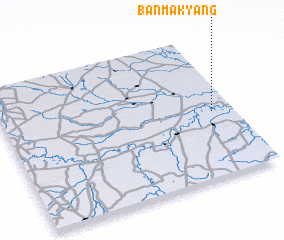 Places with similar names to Ban Makyang, Thailand ::
// Ban Makyang (LA)
Disclaimer :: Information on this page comes without warranty of any kind |
||
|
Where is Ban Makyang? Elevation and coordinates ::
Latitude (lat): 15°27'53"N Longitude (lon): 103°54'39"E
Elevation (approx.): 127m (map arrows pan, magnifying glasses zoom) |
||
|
Visiting Ban Makyang? Hotel/Accommodation ::
Book a hotel in Ban Makyang Travel Guide ::
Buy a travel guide for Thailand rental cars ::
car rental offers GPS waypoint ::
download a GPX waypoint (PoI) of Ban Makyang for your GPS receiver
|
||