|
search place name
|
||
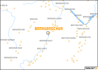
Ban Muang Chum (Chiang Rai, Thailand)Ban Muang Chum is a town in the Chiang Rai region of Thailand. An overview map of the region around Ban Muang Chum is displayed below.
regional and 3d topo map of Ban Muang Chum, Thailand ::
Ban Muang Chum airports ::
The nearest airport is THL - Tachilek Tachileik, located 64.6 km north west of Ban Muang Chum.
Other airports nearby include MOG - Mong Hsat (128.2 km west), KET - Kengtung (154.9 km north west), LPQ - Luang Prabang Luang Phabang Intl (185.3 km east), PRH - Phrae (219.7 km south), Nearby towns ::
Ban Tong (2.1km north east) //
Ban Phrao Kut (3.4km south) //
Ban Mai Don Mun (3.6km north) //
Ban Tha Charoen (4.3km north east) //
Ban Si Don Chai (4.4km north) //
Ban Lung (4.6km north east) //
Ban Dong Luang (5.7km north east) //
Ban Rong Ha (5.7km north west) //
Ban Luang (6.7km south) //
Ban Khia (7.2km north west) //
Ban Muang Chet Ton (7.4km north west) //
Ban Wai (7.5km north west) //
Ban Thung Kham (7.5km east) //
Ban Si Wilai (7.5km west) //
Ban Khrueng Nuea (8.6km south) //
Ban Khrueng Tai (8.7km south west) //
Ban Huai Ian (11.7km north east) //
Ban Huai Laeng (12.1km south east) //
[all distances 'as the bird flies' and approximate] 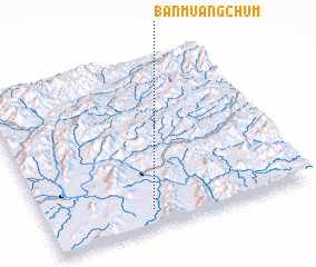 Places with similar names to Ban Muang Chum, Thailand ::
// Ban Muang Chum (TH)
// Ban Muang Chum (TH)
// Ban Muang Chum (TH)
// Ban Muang Chum (TH)
// Ban Muang Chum (TH)
// Ban Muang Chum (TH)
// Ban Muang Chum (TH)
// Ban Muang Chum (TH)
// Ban Muangcham (LA)
Disclaimer :: Information on this page comes without warranty of any kind |
||
|
Where is Ban Muang Chum? Elevation and coordinates ::
Latitude (lat): 20°6'13"N Longitude (lon): 100°24'14"E
Elevation (approx.): 371m (map arrows pan, magnifying glasses zoom) |
||
|
Visiting Ban Muang Chum? Hotel/Accommodation ::
Book a hotel in Ban Muang Chum Travel Guide ::
Buy a travel guide for Thailand rental cars ::
car rental offers GPS waypoint ::
download a GPX waypoint (PoI) of Ban Muang Chum for your GPS receiver
|
||