|
search place name
|
||
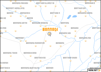
Ban Na Di (Nakhon Ratchasima, Thailand)Ban Na Di is a town in the Nakhon Ratchasima region of Thailand. An overview map of the region around Ban Na Di is displayed below.
regional and 3d topo map of Ban Na Di, Thailand ::
Ban Na Di airports ::
The nearest airport is NAK - Nakhon Ratchasima Khorat, located 71.4 km south west of Ban Na Di.
Other airports nearby include UTH - Udon Thani (218.3 km north), SNO - Sakon Nakhon (260.6 km north east), BKK - Bangkok Intl (264.4 km south west), Nearby towns ::
Ban Krok Samrong (2.6km south west) //
Ban Don Yao Yai (2.6km north east) //
Ban Don Raeng (3.7km south) //
Ban Don Muang (4.1km north west) //
Ban Bong (5.1km south east) //
Ban Hua Raroeng (5.1km north west) //
Ban Han Khai (5.4km east) //
Ban Nong Phran Pan (6.5km south west) //
Ban Fang (6.5km north east) //
Ban Thaen (7.6km north) //
Ban Na (9.1km north west) //
Ban Makha Noi (10.3km south west) //
[all distances 'as the bird flies' and approximate] 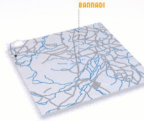 Places with similar names to Ban Na Di, Thailand ::
Disclaimer :: Information on this page comes without warranty of any kind |
||
|
Where is Ban Na Di? Elevation and coordinates ::
Latitude (lat): 15°26'0"N Longitude (lon): 102°30'0"E
Elevation (approx.): 152m (map arrows pan, magnifying glasses zoom) |
||
|
Visiting Ban Na Di? Hotel/Accommodation ::
Book a hotel in Ban Na Di Travel Guide ::
Buy a travel guide for Thailand rental cars ::
car rental offers GPS waypoint ::
download a GPX waypoint (PoI) of Ban Na Di for your GPS receiver
|
||