|
search place name
|
||
Ban Nam Phiang Din (Thailand)Ban Nam Phiang Din is a town in Thailand. An overview map of the region around Ban Nam Phiang Din is displayed below.
regional and 3d topo map of Ban Nam Phiang Din, Thailand ::

Ban Nam Phiang Din airports ::
The nearest airport is LPT - Lampang, located 200.7 km south east of Ban Nam Phiang Din.
Other airports nearby include HEH - Heho (207.1 km north west), MOG - Mong Hsat (209.9 km north east), Nearby towns ::
Ban Sop Mae Samat (0.0km north) //
Ban Yang Pu Kang Nga (2.5km south west) //
Ban Huai Chang Lek (4.2km south east) //
Wān Pōnglao (4.8km north west) //
Ban Huai Kaeo Bon (5.0km east) //
Ban Nam Phiang Din (5.8km north) //
Ban Huai Chang Tai (7.0km south east) //
Ban Mai Duea Ngom (7.3km north east) //
Ban Huai Chang Kham (7.4km south east) //
Ban Huai Kaeo Lang (8.8km north east) //
Ban Huai Pu Kaeng (9.2km north east) //
Wān Hwè-hka-nö (10.4km south west) //
Nikhom Huai Khli (10.6km north east) //
[all distances 'as the bird flies' and approximate] 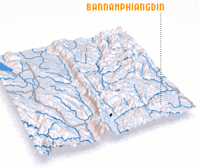 Places with similar names to Ban Nam Phiang Din, Thailand ::
// Ban Nam Phiang Din (TH)
Disclaimer :: Information on this page comes without warranty of any kind |
||
|
Where is Ban Nam Phiang Din? Elevation and coordinates ::
Latitude (lat): 19°10'0"N Longitude (lon): 97°51'0"E
Elevation (approx.): 692m (map arrows pan, magnifying glasses zoom) |
||
|
Visiting Ban Nam Phiang Din? Hotel/Accommodation ::
Book a hotel in Ban Nam Phiang Din Travel Guide ::
Buy a travel guide for Thailand rental cars ::
car rental offers GPS waypoint ::
download a GPX waypoint (PoI) of Ban Nam Phiang Din for your GPS receiver
|
||