|
search place name
|
||
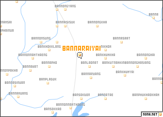
Ban Na Rai Yai (Ubon Ratchathani, Thailand)Ban Na Rai Yai is a town in the Ubon Ratchathani region of Thailand. An overview map of the region around Ban Na Rai Yai is displayed below.
regional and 3d topo map of Ban Na Rai Yai, Thailand ::
Ban Na Rai Yai airports ::
The nearest airport is ZVK - Savannakhet, located 60.9 km north of Ban Na Rai Yai.
Other airports nearby include SNO - Sakon Nakhon (142.2 km north west), PKZ - Pakse (155.9 km south east), UTH - Udon Thani (249.8 km north west), Nearby towns ::
Ban Lao Nat (2.6km south east) //
Senangkhanikhom (4.0km north east) //
Ban Na Ruang (5.0km south east) //
Ban Khum Kha (5.3km east) //
Ban Nong Thap Ma (5.7km east) //
Ban Noen Kung (6.5km north west) //
Ban Khok Klang (7.4km west) //
Ban Na Pho (7.4km west) //
Ban Kut Nam Kin (7.4km east) //
Ban Nong Kha (8.2km north east) //
Ban Rai Si Suk (8.2km north west) //
Ban Nong Sam Si (9.1km north west) //
Ban Pla Duk (9.3km south west) //
[all distances 'as the bird flies' and approximate]  Places with similar names to Ban Na Rai Yai, Thailand ::
// Ban Na Rai Yai (TH)
// Ban Rai Yai (TH)
// Ban Rai Yai (TH)
// Ban Rai Yai (TH)
// Ban Rai Yao (TH)
// Ban Rai Yao (TH)
// Ban Ru Yai (TH)
// Banārū'īyeh (IR)
// Bāna Roya (PK)
Disclaimer :: Information on this page comes without warranty of any kind |
||
|
Where is Ban Na Rai Yai? Elevation and coordinates ::
Latitude (lat): 16°1'0"N Longitude (lon): 104°39'0"E
Elevation (approx.): 156m (map arrows pan, magnifying glasses zoom) |
||
|
Visiting Ban Na Rai Yai? Hotel/Accommodation ::
Book a hotel in Ban Na Rai Yai Travel Guide ::
Buy a travel guide for Thailand rental cars ::
car rental offers GPS waypoint ::
download a GPX waypoint (PoI) of Ban Na Rai Yai for your GPS receiver
|
||