|
search place name
|
||
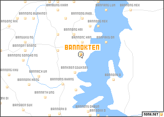
Ban Nok Ten (Ubon Ratchathani, Thailand)Ban Nok Ten is a town in the Ubon Ratchathani region of Thailand. An overview map of the region around Ban Nok Ten is displayed below.
regional and 3d topo map of Ban Nok Ten, Thailand ::
Ban Nok Ten airports ::
The nearest airport is PKZ - Pakse, located 49.4 km east of Ban Nok Ten.
Other airports nearby include ZVK - Savannakhet (179.4 km north), REP - Siem-reap Siem Reap (243.2 km south west), Nearby towns ::
Ban Kaeng Duk Sai (3.5km south west) //
Ban Non Chan (3.7km north) //
Ban Nong Hai (5.8km north) //
Ban Ang Hin Yai (5.7km west) //
Ban Fak Dom (6.5km north east) //
Ban Non Ka Long (7.3km south) //
Ban Non Sawang (7.3km south west) //
Ban Non Chik Noi (7.6km north) //
Ban Don Ko (7.7km north west) //
Ban Nong Mek (8.2km north east) //
Ban Non Ko (8.5km south east) //
Ban Na Thung (12.0km south west) //
[all distances 'as the bird flies' and approximate] 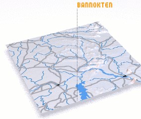 Places with similar names to Ban Nok Ten, Thailand ::
// Banguitan (PH)
// Ban Kadan (TH)
// Ban Kat Nua (TH)
// Ban Ko Ai Duan (TH)
// Ban Ko Taen (TH)
// Ban Kut Nao (TH)
// Ban Kut Noi (TH)
// Benguéden (BF)
// Ban Kadan (LA)
// Ban Kadan (LA)
Disclaimer :: Information on this page comes without warranty of any kind |
||
|
Where is Ban Nok Ten? Elevation and coordinates ::
Latitude (lat): 15°2'0"N Longitude (lon): 105°20'0"E
Elevation (approx.): 151m (map arrows pan, magnifying glasses zoom) |
||
|
Visiting Ban Nok Ten? Hotel/Accommodation ::
Book a hotel in Ban Nok Ten Travel Guide ::
Buy a travel guide for Thailand rental cars ::
car rental offers GPS waypoint ::
download a GPX waypoint (PoI) of Ban Nok Ten for your GPS receiver
|
||