|
search place name
|
||
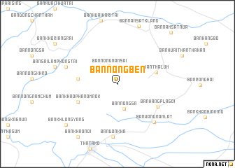
Ban Nong Ben (Nakhon Sawan, Thailand)Ban Nong Ben is a town in the Nakhon Sawan region of Thailand. An overview map of the region around Ban Nong Ben is displayed below.
regional and 3d topo map of Ban Nong Ben, Thailand ::
Ban Nong Ben airports ::
The nearest airport is PHS - Phitsanulok, located 119.9 km north of Ban Nong Ben.
Other airports nearby include NAK - Nakhon Ratchasima Khorat (188.6 km south east), BKK - Bangkok Intl (200.8 km south), LOE - Loei (228.7 km north east), Nearby towns ::
Ban Nong Nam Sai (3.1km north west) //
Ban Nong Sa (4.1km south) //
Ban Chalom Nae (6.1km west) //
Ban Tha Lum (6.2km east) //
Ban Khao Phanom Rok (6.7km south west) //
Ban Wang Pla Soi (7.2km south east) //
Ban Wang Nam Lat (8.3km south east) //
Ban Don Kha (8.5km south) //
Ban Noen Tak Sian (8.3km west) //
Ban Khlong Yang (10.2km south west) //
Ban Khao Noi (10.4km south west) //
Ban Nam Sat Nua (11.6km north east) //
[all distances 'as the bird flies' and approximate]  Places with similar names to Ban Nong Ben, Thailand ::
// Ban Nong Baen (TH)
// Ban Nong Baen (TH)
// Ban Nong Baen (TH)
// Ban Nong Ben (TH)
// Ban Nong Ben (TH)
// Ban Nong Ben (TH)
// Ban Nong Ben (TH)
// Ban Nong Ben (TH)
// Ban Nong Bon (TH)
// Ban Nong Bon (TH)
Disclaimer :: Information on this page comes without warranty of any kind |
||
|
Where is Ban Nong Ben? Elevation and coordinates ::
Latitude (lat): 15°43'33"N Longitude (lon): 100°31'24"E
Elevation (approx.): 34m (map arrows pan, magnifying glasses zoom) |
||
|
Visiting Ban Nong Ben? Hotel/Accommodation ::
Book a hotel in Ban Nong Ben Travel Guide ::
Buy a travel guide for Thailand rental cars ::
car rental offers GPS waypoint ::
download a GPX waypoint (PoI) of Ban Nong Ben for your GPS receiver
|
||