|
search place name
|
||
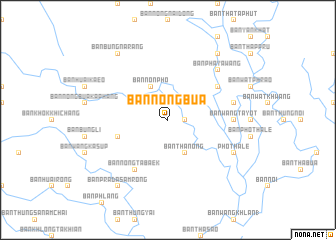
Ban Nong Bua (Phichit, Thailand)Ban Nong Bua is a town in the Phichit region of Thailand. An overview map of the region around Ban Nong Bua is displayed below.
regional and 3d topo map of Ban Nong Bua, Thailand ::
Ban Nong Bua airports ::
The nearest airport is PHS - Phitsanulok, located 74.2 km north of Ban Nong Bua.
Other airports nearby include LOE - Loei (218.5 km north east), NAK - Nakhon Ratchasima Khorat (240.3 km south east), Nearby towns ::
Ban Thung Khi Lek (1.8km east) //
Ban Non Pho (4.1km north west) //
Ban Thanong (4.1km south east) //
Ban Bung Kradan (5.7km west) //
Ban Wang Hin (6.5km north east) //
Ban Nong Tabaek (6.6km south west) //
Ban Wang Ta Yot (7.1km east) //
Ban Tha Tae (7.4km east) //
Ban Phaya Wang (7.7km north east) //
Pho Thale (8.0km south east) //
Ban Bang Lai (1) (9.1km north east) //
Ban Bung Na Rang (9.1km north west) //
Ban Prada Samrong (9.1km south west) //
[all distances 'as the bird flies' and approximate]  Places with similar names to Ban Nong Bua, Thailand ::
// Ban Ang (1) (TH)
// Ban Na Nok (1) (TH)
// Ban Nong Bo (TH)
// Ban Nong Bia (TH)
// Ban Nong Bo (TH)
// Ban Nong Bo (TH)
// Ban Nong Bo (TH)
// Ban Nong Bo (TH)
// Ban Nong Bo (TH)
// Ban Nong Bo (TH)
Disclaimer :: Information on this page comes without warranty of any kind |
||
|
Where is Ban Nong Bua? Elevation and coordinates ::
Latitude (lat): 16°7'0"N Longitude (lon): 100°12'0"E
Elevation (approx.): 33m (map arrows pan, magnifying glasses zoom) |
||
|
Visiting Ban Nong Bua? Hotel/Accommodation ::
Book a hotel in Ban Nong Bua Travel Guide ::
Buy a travel guide for Thailand rental cars ::
car rental offers GPS waypoint ::
download a GPX waypoint (PoI) of Ban Nong Bua for your GPS receiver
|
||