|
search place name
|
||
Ban Nong Khun (Ubon Ratchathani, Thailand)Ban Nong Khun is a town in the Ubon Ratchathani region of Thailand. An overview map of the region around Ban Nong Khun is displayed below.
regional and 3d topo map of Ban Nong Khun, Thailand ::

Ban Nong Khun airports ::
The nearest airport is PKZ - Pakse, located 66.1 km south east of Ban Nong Khun.
Other airports nearby include ZVK - Savannakhet (134.9 km north west), SNO - Sakon Nakhon (229.4 km north west), Nearby towns ::
Ban Kham Toei (4.0km north west) //
Ban Na Du (5.1km south east) //
Ban Sang Wa (5.7km west) //
Ban Non Nong Bua (5.7km east) //
Ban Don Yai (5.7km east) //
Ban Na Phaeng (5.8km south) //
Khong Chiam (5.8km north) //
Si Muang Mai (6.6km north east) //
Ban Don Tai (6.6km north west) //
Ban Na Uat (7.4km north) //
Amphoe Si Muang Mai (7.6km south) //
Ban Don Ko (7.7km north west) //
Ban Don (8.0km north west) //
Ban Na Thom Yai (9.1km south west) //
Ban Nong Hang (9.1km north east) //
Ban Don Pho (10.3km south west) //
Ban Kham Chan (10.3km south east) //
[all distances 'as the bird flies' and approximate] 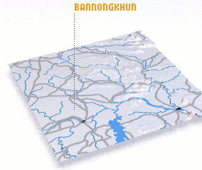 Places with similar names to Ban Nong Khun, Thailand ::
// Ban Nong Khaen (TH)
// Ban Nong Khaen (TH)
// Ban Nong Khaen (TH)
// Ban Nong Khaen (TH)
// Ban Nong Khaen (TH)
// Ban Nong Khaen (TH)
// Ban Nong Khaen (TH)
// Ban Nong Khaen (TH)
// Ban Nong Khaen (TH)
// Ban Nong Khaen (TH)
Disclaimer :: Information on this page comes without warranty of any kind |
||
|
Where is Ban Nong Khun? Elevation and coordinates ::
Latitude (lat): 15°26'0"N Longitude (lon): 105°15'0"E
Elevation (approx.): 139m (map arrows pan, magnifying glasses zoom) |
||
|
Visiting Ban Nong Khun? Hotel/Accommodation ::
Book a hotel in Ban Nong Khun Travel Guide ::
Buy a travel guide for Thailand rental cars ::
car rental offers GPS waypoint ::
download a GPX waypoint (PoI) of Ban Nong Khun for your GPS receiver
|
||