|
search place name
|
||
Ban Nong Kum (Suphan Buri, Thailand)Ban Nong Kum is a town in the Suphan Buri region of Thailand. An overview map of the region around Ban Nong Kum is displayed below.
regional and 3d topo map of Ban Nong Kum, Thailand ::

Ban Nong Kum airports ::
The nearest airport is BKK - Bangkok Intl, located 83.1 km south east of Ban Nong Kum.
Other airports nearby include HHQ - Prachuap Khiri Khan Hua Hin (209.1 km south), NAK - Nakhon Ratchasima Khorat (212.8 km east), UTP - Rayong U Taphao Intl (223.3 km south east), Nearby towns ::
Ban Na Thong (0.0km north) //
Ban Don Pho (1.8km east) //
Ban Pho Klang (1.9km south) //
Ban Song (1) (2.6km north west) //
Ban Pak Krot (2.6km south east) //
Ban Nong Paet Kham (3.6km east) //
Ban Thammakun (3.6km west) //
Ban Pho Phraya (4.0km north west) //
Ban Talat Daeng (4.0km north west) //
Ban Don Klang (4.1km south east) //
Ban Noi (4.1km south west) //
Ban Don Krabuang (5.2km north east) //
Ban Don Masang (5.2km north east) //
Ban Don Phutsa (5.2km north east) //
Ban Don Tan (5.2km south east) //
Ban Rang Krathum (5.6km south) //
Ban Don Tako (5.7km east) //
Ban Mot Daeng (5.8km north) //
Ban Lat Tan (6.5km north east) //
Suphan Buri (6.6km south west) //
Ban Wang Kum (6.5km north west) //
Ban Phai Ko (6.5km south east) //
Ban Sao Rong Hai (1) (7.2km north east) //
Ban Wang Yang Yai (1) (7.4km north) //
Ban Tan Sian (7.4km north) //
Ban Phai Khwang (1) (7.4km south) //
Ban Pho Tha Sai (7.4km west) //
Ban Don Sakae (7.4km east) //
Ban Pho (7.4km west) //
[all distances 'as the bird flies' and approximate] 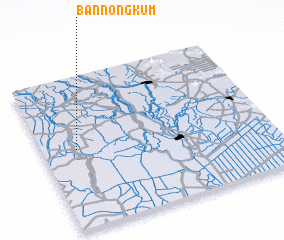 Places with similar names to Ban Nong Kum, Thailand ::
// Ban Nong Kamui (TH)
// Ban Nong Kum (TH)
// Ban Nong Kum (TH)
// Ban Nong Kum (TH)
// Ban Nongkam (LA)
// Ban Nong Kome (LA)
Disclaimer :: Information on this page comes without warranty of any kind |
||
|
Where is Ban Nong Kum? Elevation and coordinates ::
Latitude (lat): 14°31'0"N Longitude (lon): 100°9'0"E
Elevation (approx.): 10m (map arrows pan, magnifying glasses zoom) |
||
|
Visiting Ban Nong Kum? Hotel/Accommodation ::
Book a hotel in Ban Nong Kum Travel Guide ::
Buy a travel guide for Thailand rental cars ::
car rental offers GPS waypoint ::
download a GPX waypoint (PoI) of Ban Nong Kum for your GPS receiver
|
||