|
search place name
|
||
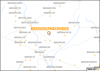
Ban Nong Phak Phaeo (Ubon Ratchathani, Thailand)Ban Nong Phak Phaeo is a town in the Ubon Ratchathani region of Thailand. An overview map of the region around Ban Nong Phak Phaeo is displayed below.
regional and 3d topo map of Ban Nong Phak Phaeo, Thailand ::
Ban Nong Phak Phaeo airports ::
The nearest airport is PKZ - Pakse, located 71.9 km south east of Ban Nong Phak Phaeo.
Other airports nearby include ZVK - Savannakhet (123.0 km north west), SNO - Sakon Nakhon (219.0 km north west), Nearby towns ::
Ban Pa Kung Noi (1.9km south) //
Ban Pa Kung Yai (2.6km south west) //
Ban Ba Hi (4.0km north east) //
Ban Fa Huan (5.1km south east) //
Ban Pa Kung Yai (5.4km east) //
Ban Kham Bong (5.7km west) //
Ban Na Kham (5.8km south) //
Ban Phon Ngam (6.5km south west) //
Ban Phu Lon (7.4km north) //
Ban Pong (7.7km north west) //
Ban Bok (7.7km south west) //
Ban Tunglung Nua (8.0km north west) //
Ban Na Uat (8.2km south west) //
Ban Muang (9.0km north west) //
[all distances 'as the bird flies' and approximate] 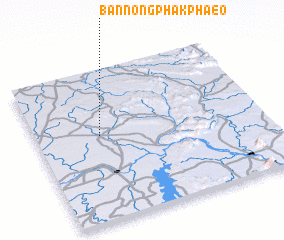 Places with similar names to Ban Nong Phak Phaeo, Thailand :: Disclaimer :: Information on this page comes without warranty of any kind |
||
|
Where is Ban Nong Phak Phaeo? Elevation and coordinates ::
Latitude (lat): 15°34'0"N Longitude (lon): 105°17'0"E
Elevation (approx.): 152m (map arrows pan, magnifying glasses zoom) |
||
|
Visiting Ban Nong Phak Phaeo? Hotel/Accommodation ::
Book a hotel in Ban Nong Phak Phaeo Travel Guide ::
Buy a travel guide for Thailand rental cars ::
car rental offers GPS waypoint ::
download a GPX waypoint (PoI) of Ban Nong Phak Phaeo for your GPS receiver
|
||