|
search place name
|
||
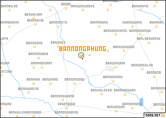
Ban Nong Phung (Roi Et, Thailand)Ban Nong Phung is a town in the Roi Et region of Thailand. An overview map of the region around Ban Nong Phung is displayed below.
regional and 3d topo map of Ban Nong Phung, Thailand ::
Ban Nong Phung airports ::
The nearest airport is ZVK - Savannakhet, located 151.4 km north east of Ban Nong Phung.
Other airports nearby include SNO - Sakon Nakhon (168.7 km north), NAK - Nakhon Ratchasima Khorat (188.2 km south west), UTH - Udon Thani (201.5 km north west), LOE - Loei (275.3 km north west), Nearby towns ::
Ban Hua Nong (1.6km north east) //
Ban Nong Chang (2.5km north east) //
Ban I Meng (5.7km east) //
Ban Nong Sao (5.8km south) //
Ban I Khot (6.0km north west) //
Ban Dong Man (7.4km east) //
Ban Pa Sang (8.2km north east) //
Ban Non Sang (8.2km south east) //
Ban Khilek Sai (8.9km south east) //
Ban Dong Kheng (9.0km north east) //
Ban Nong To (9.1km north west) //
Ban Um Mao (9.0km south west) //
[all distances 'as the bird flies' and approximate]  Places with similar names to Ban Nong Phung, Thailand ::
// Ban Nong Pha-ong (TH)
// Ban Nong Pha-ung (TH)
// Ban Nong Phong (TH)
// Ban Nong Phong (TH)
// Ban Nongphang (LA)
// Ban Nongpheung (LA)
// Ban Nong Vèng (LA)
// Ban Nong Vèng (LA)
// Ban Nong Veung (LA)
Disclaimer :: Information on this page comes without warranty of any kind |
||
|
Where is Ban Nong Phung? Elevation and coordinates ::
Latitude (lat): 15°45'0"N Longitude (lon): 103°37'0"E
Elevation (approx.): 132m (map arrows pan, magnifying glasses zoom) |
||
|
Visiting Ban Nong Phung? Hotel/Accommodation ::
Book a hotel in Ban Nong Phung Travel Guide ::
Buy a travel guide for Thailand rental cars ::
car rental offers GPS waypoint ::
download a GPX waypoint (PoI) of Ban Nong Phung for your GPS receiver
|
||