|
search place name
|
||
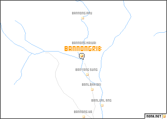
Ban Nong Ri (1) (Kanchanaburi, Thailand)Ban Nong Ri (1) is a town in the Kanchanaburi region of Thailand. An overview map of the region around Ban Nong Ri (1) is displayed below.
regional and 3d topo map of Ban Nong Ri (1), Thailand ::
Ban Nong Ri (1) airports ::
The nearest airport is BKK - Bangkok Intl, located 140.7 km south east of Ban Nong Ri (1).
Other airports nearby include HHQ - Prachuap Khiri Khan Hua Hin (215.3 km south), UTP - Rayong U Taphao Intl (263.5 km south east), Nearby towns ::
Ban Nong Mai Uai (2.6km north) //
Ban Nong Khai Kai (3.0km north) //
Ban Yang Sung (3.5km south) //
Ban Lam Hoei (7.0km south) //
[all distances 'as the bird flies' and approximate] 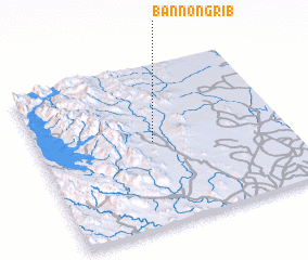 Places with similar names to Ban Nong Ri (1), Thailand ::
Disclaimer :: Information on this page comes without warranty of any kind |
||
|
Where is Ban Nong Ri (1)? Elevation and coordinates ::
Latitude (lat): 14°31'23"N Longitude (lon): 99°27'46"E
Elevation (approx.): 115m (map arrows pan, magnifying glasses zoom) |
||
|
Visiting Ban Nong Ri (1)? Hotel/Accommodation ::
Book a hotel in Ban Nong Ri (1) Travel Guide ::
Buy a travel guide for Thailand rental cars ::
car rental offers GPS waypoint ::
download a GPX waypoint (PoI) of Ban Nong Ri (1) for your GPS receiver
|
||