|
search place name
|
||
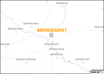
Ban Nong Samet (Prachin Buri, Thailand)Ban Nong Samet is a town in the Prachin Buri region of Thailand. An overview map of the region around Ban Nong Samet is displayed below.
regional and 3d topo map of Ban Nong Samet, Thailand ::
Ban Nong Samet airports ::
The nearest airport is REP - Siem-reap Siem Reap, located 129.2 km east of Ban Nong Samet.
Other airports nearby include NAK - Nakhon Ratchasima Khorat (139.1 km north west), UTP - Rayong U Taphao Intl (223.7 km south west), Nearby towns ::
Ban Don Lum (1.9km south) //
Ban Khok Sung (3.7km south) //
Ban Non Mak Mun (5.8km south) //
Ban Non Sung (7.6km south) //
Ban Kut Phu (8.2km south east) //
Ban Nong Waeng (8.1km north west) //
Phumĭ Yéang Dângkŭm (1) (10.5km south east) //
[all distances 'as the bird flies' and approximate] 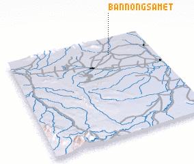 Places with similar names to Ban Nong Samet, Thailand ::
// Ban Nong Samet (TH)
// Ban Nong Samet (TH)
// Ban Nong Samet (TH)
// Ban Nong Samet (TH)
// Ban Nong Samet (TH)
// Ban Nong Samet (TH)
// Ban Nong Samet (4) (TH)
Disclaimer :: Information on this page comes without warranty of any kind |
||
|
Where is Ban Nong Samet? Elevation and coordinates ::
Latitude (lat): 13°50'0"N Longitude (lon): 102°42'0"E
Elevation (approx.): 53m (map arrows pan, magnifying glasses zoom) |
||
|
Visiting Ban Nong Samet? Hotel/Accommodation ::
Book a hotel in Ban Nong Samet Travel Guide ::
Buy a travel guide for Thailand rental cars ::
car rental offers GPS waypoint ::
download a GPX waypoint (PoI) of Ban Nong Samet for your GPS receiver
|
||