|
search place name
|
||
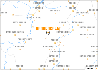
Ban Non Ka Len (Ubon Ratchathani, Thailand)Ban Non Ka Len is a town in the Ubon Ratchathani region of Thailand. An overview map of the region around Ban Non Ka Len is displayed below.
regional and 3d topo map of Ban Non Ka Len, Thailand ::
Ban Non Ka Len airports ::
The nearest airport is PKZ - Pakse, located 111.4 km east of Ban Non Ka Len.
Other airports nearby include ZVK - Savannakhet (168.6 km north), REP - Siem-reap Siem Reap (206.1 km south west), Nearby towns ::
Ban Phon Ngam (1.6km south west) //
Ban Wan (3.7km south east) //
Ban Bon (4.0km north east) //
Ban Samrong (4.9km south east) //
Ban Nam Kiam (5.2km south east) //
Ban Nong Thao (5.4km east) //
Ban Nong Sim (5.6km south) //
Ban Nam Klang (5.8km south) //
Ban Na Nuan (5.8km south) //
Ban Nong Song Hong (6.5km south east) //
Ban Kho (6.5km north east) //
Ban Don Phung (6.7km north west) //
Ban Nam Thiang (7.7km north west) //
Ban Sang Ngon (8.2km south east) //
Ban Non Sai (8.6km north) //
Ban Huai Khayung (9.6km north west) //
[all distances 'as the bird flies' and approximate]  Places with similar names to Ban Non Ka Len, Thailand ::
Disclaimer :: Information on this page comes without warranty of any kind |
||
|
Where is Ban Non Ka Len? Elevation and coordinates ::
Latitude (lat): 15°2'0"N Longitude (lon): 104°45'0"E
Elevation (approx.): 142m (map arrows pan, magnifying glasses zoom) |
||
|
Visiting Ban Non Ka Len? Hotel/Accommodation ::
Book a hotel in Ban Non Ka Len Travel Guide ::
Buy a travel guide for Thailand rental cars ::
car rental offers GPS waypoint ::
download a GPX waypoint (PoI) of Ban Non Ka Len for your GPS receiver
|
||