|
search place name
|
||
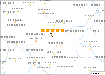
Ban Non Ngiu (Nakhon Ratchasima, Thailand)Ban Non Ngiu is a town in the Nakhon Ratchasima region of Thailand. An overview map of the region around Ban Non Ngiu is displayed below.
regional and 3d topo map of Ban Non Ngiu, Thailand ::
Ban Non Ngiu airports ::
The nearest airport is NAK - Nakhon Ratchasima Khorat, located 54.9 km south of Ban Non Ngiu.
Other airports nearby include BKK - Bangkok Intl (222.9 km south west), UTH - Udon Thani (234.1 km north), PHS - Phitsanulok (236.1 km north west), Nearby towns ::
Ban Huai Sam Kha (3.1km south) //
Ban Thap Rang (4.2km south east) //
Ban Nong Yang (4.5km north) //
Ban Teng Tia (5.8km west) //
Ban Nong Song Hong (5.8km west) //
Ban Kut Ta Dam (6.0km south) //
Ban Krok Phra Ngao (6.1km east) //
Ban Nong Rang Ka (6.5km north east) //
Ban Krok Ta Paen (7.9km north) //
Ban Thamnop Khaman (7.8km east) //
Ban Non Sanga (8.2km south) //
Ban Thanon Khong (8.3km south west) //
Ban Charoen Phon (9.9km south west) //
Ban Nong Kok Ri (11.1km south east) //
[all distances 'as the bird flies' and approximate]  Places with similar names to Ban Non Ngiu, Thailand ::
// Ban Na Ngiu (TH)
// Ban Na Ngiu (TH)
// Ban Na Ngiu (TH)
// Ban Na Ngiu (TH)
// Ban Non Ngiu (TH)
// Ban Non Ngiu (TH)
// Ban Non Ngiu (TH)
// Banangi (CF)
// Binangi (CD)
// Bonangi (IN)
Disclaimer :: Information on this page comes without warranty of any kind |
||
|
Where is Ban Non Ngiu? Elevation and coordinates ::
Latitude (lat): 15°25'15"N Longitude (lon): 101°58'42"E
Elevation (approx.): 225m (map arrows pan, magnifying glasses zoom) |
||
|
Visiting Ban Non Ngiu? Hotel/Accommodation ::
Book a hotel in Ban Non Ngiu Travel Guide ::
Buy a travel guide for Thailand rental cars ::
car rental offers GPS waypoint ::
download a GPX waypoint (PoI) of Ban Non Ngiu for your GPS receiver
|
||