|
search place name
|
||
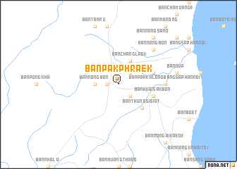
Ban Pak Phraek (Prachuap Khiri Khan, Thailand)Ban Pak Phraek is a town in the Prachuap Khiri Khan region of Thailand. An overview map of the region around Ban Pak Phraek is displayed below.
regional and 3d topo map of Ban Pak Phraek, Thailand ::
Ban Pak Phraek airports ::
The nearest airport is MGZ - Myeik, located 176.4 km north west of Ban Pak Phraek.
Other airports nearby include HHQ - Prachuap Khiri Khan Hua Hin (187.8 km north), UTP - Rayong U Taphao Intl (253.8 km north east), Nearby towns ::
Ban Sam Yaek Huai Sak (1.8km west) //
Ban Khiam En (2.6km south east) //
Ban Hit Pit (2.6km north east) //
Ban Hin Pit (3.6km west) //
Ban Nong Bon (3.6km west) //
Ban Chang Laek (4.1km north east) //
Ban Thung Si Siat (5.2km south east) //
Ban Huai Sak Bon (5.8km east) //
Ban Nong Wai Khwat (5.8km east) //
Ban Nong Khong (7.3km east) //
Ban Pak Khlong Bang Saphan Noi (7.3km east) //
Ban Nong Bon (7.8km north east) //
Ban Nong Sano (9.2km north east) //
[all distances 'as the bird flies' and approximate] 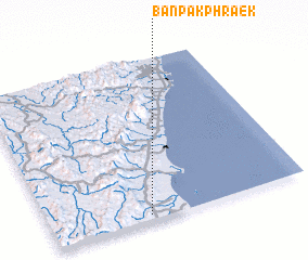 Places with similar names to Ban Pak Phraek, Thailand ::
// Ban Pak Phraek (TH)
// Ban Pak Phraek (TH)
// Ban Pak Phraek (TH)
// Ban Pak Phraek (TH)
// Ban Pak Phraek (TH)
// Ban Pak Phraek (TH)
// Ban Pak Phraek (TH)
// Ban Pak Phraek (TH)
Disclaimer :: Information on this page comes without warranty of any kind |
||
|
Where is Ban Pak Phraek? Elevation and coordinates ::
Latitude (lat): 11°2'0"N Longitude (lon): 99°23'0"E
Elevation (approx.): 50m (map arrows pan, magnifying glasses zoom) |
||
|
Visiting Ban Pak Phraek? Hotel/Accommodation ::
Book a hotel in Ban Pak Phraek Travel Guide ::
Buy a travel guide for Thailand rental cars ::
car rental offers GPS waypoint ::
download a GPX waypoint (PoI) of Ban Pak Phraek for your GPS receiver
|
||