|
search place name
|
||
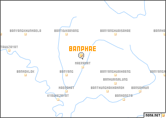
Ban Phae (Tak, Thailand)Ban Phae is a town in the Tak region of Thailand. An overview map of the region around Ban Phae is displayed below.
regional and 3d topo map of Ban Phae, Thailand ::
Ban Phae airports ::
The nearest airport is LPT - Lampang, located 170.3 km north east of Ban Phae.
Other airports nearby include PHS - Phitsanulok (186.3 km east), PRH - Phrae (210.2 km north east), Nearby towns ::
Mae Ramat (1.9km south) //
Ban Phu Mia (5.1km south west) //
Ban Yang (5.1km south west) //
Ban Tidi Kariang (6.6km north west) //
Mae Ramat (8.2km south west) //
Ban Talu Lae (8.0km south east) //
Ban Yang (8.0km south east) //
Ban Yang Huai Haeng (8.0km south east) //
Ban Thung Makham Pom (9.1km south east) //
Ban Huai Salung (9.0km south east) //
Ban Pha Ka (9.0km north east) //
Ban Yang Huai Samae (9.0km north east) //
Ban Phapoe (9.0km north east) //
[all distances 'as the bird flies' and approximate] 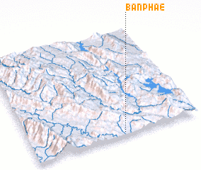 Places with similar names to Ban Phae, Thailand ::
Disclaimer :: Information on this page comes without warranty of any kind |
||
|
Where is Ban Phae? Elevation and coordinates ::
Latitude (lat): 17°2'0"N Longitude (lon): 98°33'0"E
Elevation (approx.): 234m (map arrows pan, magnifying glasses zoom) |
||
|
Visiting Ban Phae? Hotel/Accommodation ::
Book a hotel in Ban Phae Travel Guide ::
Buy a travel guide for Thailand rental cars ::
car rental offers GPS waypoint ::
download a GPX waypoint (PoI) of Ban Phae for your GPS receiver
|
||