|
search place name
|
||
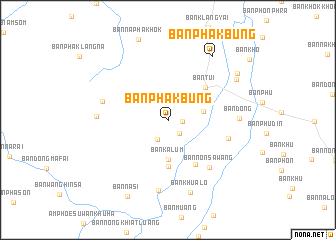
Ban Phak Bung (Udon Thani, Thailand)Ban Phak Bung is a town in the Udon Thani region of Thailand. An overview map of the region around Ban Phak Bung is displayed below.
regional and 3d topo map of Ban Phak Bung, Thailand ::
Ban Phak Bung airports ::
The nearest airport is VTE - Vientiane Wattay Intl, located 40.4 km north east of Ban Phak Bung.
Other airports nearby include UTH - Udon Thani (56.4 km south east), LOE - Loei (72.4 km west), SNO - Sakon Nakhon (194.9 km east), Nearby towns ::
Ban Muang Phan (1.6km east) //
Ban Wang Suai (2.0km south east) //
Ban Wang Sai (2.4km south west) //
Ban Tiu (3.9km east) //
Ban Kalum (4.4km south) //
Ban Champa Mong (5.2km south) //
Ban Tui (5.4km north east) //
Ban Champa Khong (5.8km south east) //
Ban Non Sawang (6.9km south east) //
Ban Na Kham (6.8km east) //
Ban Dong Phatthana (7.3km west) //
Ban Dong (7.6km east) //
Ban Don Ho (8.0km south) //
Ban Huai Hea (7.6km west) //
Ban Khua Lo (8.4km south) //
Ban Phak Bung (8.5km north east) //
Ban Phon Phra (8.6km north east) //
Ban Narai (9.0km north east) //
Ban Na Si (9.5km south west) //
[all distances 'as the bird flies' and approximate] 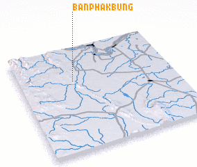 Places with similar names to Ban Phak Bung, Thailand ::
Disclaimer :: Information on this page comes without warranty of any kind |
||
|
Where is Ban Phak Bung? Elevation and coordinates ::
Latitude (lat): 17°40'56"N Longitude (lon): 102°21'20"E
Elevation (approx.): 190m (map arrows pan, magnifying glasses zoom) |
||
|
Visiting Ban Phak Bung? Hotel/Accommodation ::
Book a hotel in Ban Phak Bung Travel Guide ::
Buy a travel guide for Thailand rental cars ::
car rental offers GPS waypoint ::
download a GPX waypoint (PoI) of Ban Phak Bung for your GPS receiver
|
||