|
search place name
|
||
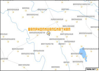
Ban Phon Muang Mathan (Ubon Ratchathani, Thailand)Ban Phon Muang Mathan is a town in the Ubon Ratchathani region of Thailand. An overview map of the region around Ban Phon Muang Mathan is displayed below.
regional and 3d topo map of Ban Phon Muang Mathan, Thailand ::
Ban Phon Muang Mathan airports ::
The nearest airport is ZVK - Savannakhet, located 120.3 km north of Ban Phon Muang Mathan.
Other airports nearby include PKZ - Pakse (121.3 km east), SNO - Sakon Nakhon (201.0 km north), UTH - Udon Thani (294.9 km north west), Nearby towns ::
Ban Phung (2.8km east) //
Ban Phon Phaeng (3.6km south east) //
Ban Thung Tai (4.2km south) //
Ban Don Daeng Yai (4.5km west) //
Ban Thepha (4.8km east) //
Muang Sam Sip (5.9km north east) //
Ban Na Rai Yai (6.0km west) //
Ban Pet (6.1km south east) //
Ban Nong Faek (6.4km east) //
Ban Yang Khua (6.4km east) //
Ban Lao Khao (7.4km east) //
Ban Duai Kai (7.7km south west) //
Ban Sombun (8.0km south east) //
Ban Nam Kham Noi (8.3km north east) //
Ban Nam Om (9.2km north) //
Ban Nong Khu (9.3km north west) //
Ban Dong Yang (11.1km south west) //
Ban Bok (11.3km south east) //
[all distances 'as the bird flies' and approximate] 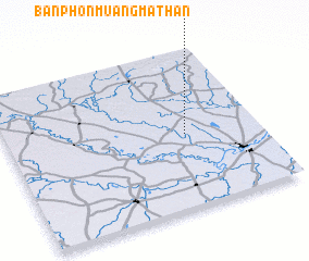 Places with similar names to Ban Phon Muang Mathan, Thailand :: Disclaimer :: Information on this page comes without warranty of any kind |
||
|
Where is Ban Phon Muang Mathan? Elevation and coordinates ::
Latitude (lat): 15°28'13"N Longitude (lon): 104°42'27"E
Elevation (approx.): 135m (map arrows pan, magnifying glasses zoom) |
||
|
Visiting Ban Phon Muang Mathan? Hotel/Accommodation ::
Book a hotel in Ban Phon Muang Mathan Travel Guide ::
Buy a travel guide for Thailand rental cars ::
car rental offers GPS waypoint ::
download a GPX waypoint (PoI) of Ban Phon Muang Mathan for your GPS receiver
|
||