|
search place name
|
||
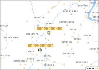
Ban Phon Phra (Nong Khai, Thailand)Ban Phon Phra is a town in the Nong Khai region of Thailand. An overview map of the region around Ban Phon Phra is displayed below.
regional and 3d topo map of Ban Phon Phra, Thailand ::
Ban Phon Phra airports ::
The nearest airport is VTE - Vientiane Wattay Intl, located 25.6 km north east of Ban Phon Phra.
Other airports nearby include UTH - Udon Thani (56.3 km south east), LOE - Loei (86.5 km south west), SNO - Sakon Nakhon (188.3 km east), Nearby towns ::
Ban Nong Kong (2.0km south) //
Ban Na Kha (2.6km north east) //
Ban Kuat (3.3km north) //
Ban Kho (4.7km south west) //
Ban Khok Khon (5.4km east) //
Ban Klang Yai (6.2km west) //
Ban Narai (6.6km south west) //
Ban Pho Tak (6.6km north west) //
Ban Phak Bung (7.0km south west) //
Ban Phon Phra (7.3km south west) //
Ban Nong Waeng (7.4km north east) //
Ban Na Kham (7.5km south east) //
Ban Klang Noi (8.1km east) //
Ban Phon Thong (8.7km north) //
Ban Huai Sok (9.5km south east) //
Ban Kham Duang (9.6km north west) //
Ban Tui (9.8km south west) //
Ban Dong Wai (10.9km south east) //
Ban Tha Samran (11.1km north east) //
[all distances 'as the bird flies' and approximate] 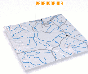 Places with similar names to Ban Phon Phra, Thailand ::
// Ban Phan Phra (TH)
// Ban Phon Phra (TH)
Disclaimer :: Information on this page comes without warranty of any kind |
||
|
Where is Ban Phon Phra? Elevation and coordinates ::
Latitude (lat): 17°46'55"N Longitude (lon): 102°27'15"E
Elevation (approx.): 179m (map arrows pan, magnifying glasses zoom) |
||
|
Visiting Ban Phon Phra? Hotel/Accommodation ::
Book a hotel in Ban Phon Phra Travel Guide ::
Buy a travel guide for Thailand rental cars ::
car rental offers GPS waypoint ::
download a GPX waypoint (PoI) of Ban Phon Phra for your GPS receiver
|
||