|
search place name
|
||
Ban Phra Khru (Buriram, Thailand)Ban Phra Khru is a town in the Buriram region of Thailand. An overview map of the region around Ban Phra Khru is displayed below.
regional and 3d topo map of Ban Phra Khru, Thailand ::

Ban Phra Khru airports ::
The nearest airport is NAK - Nakhon Ratchasima Khorat, located 106.1 km west of Ban Phra Khru.
Other airports nearby include REP - Siem-reap Siem Reap (204.2 km south east), ZVK - Savannakhet (244.0 km north east), Nearby towns ::
Ban Nong Phluang (2.6km south east) //
Ban Sa Ket (3.7km south) //
Ban Boi (4.0km south west) //
Ban Nong Phak Waen (4.1km north east) //
Ban Kalantha (5.7km east) //
Ban Nong Pru (5.8km south) //
Ban Ta Lam (5.8km north) //
Ban Karako (5.8km north) //
Ban Na Klang (6.6km south west) //
Ban Nong Kao Kha (7.2km west) //
Ban Chok Di (7.4km east) //
Ban Takhlo (7.6km north) //
Ban Samrong (1) (7.6km north) //
Ban Khok Sa-at (8.2km south west) //
Ban Nong Waeng (8.1km north west) //
Ban Krok Khi Nu (8.2km south east) //
Ban Hua Fai (1) (8.2km north east) //
Ban Nong Muang (9.0km south west) //
Ban Nong Song Hong (2) (9.2km north west) //
Ban Nong Muang (10.3km south east) //
[all distances 'as the bird flies' and approximate] 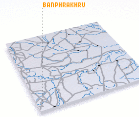 Places with similar names to Ban Phra Khru, Thailand :: Disclaimer :: Information on this page comes without warranty of any kind |
||
|
Where is Ban Phra Khru? Elevation and coordinates ::
Latitude (lat): 15°6'0"N Longitude (lon): 103°3'0"E
Elevation (approx.): 162m (map arrows pan, magnifying glasses zoom) |
||
|
Visiting Ban Phra Khru? Hotel/Accommodation ::
Book a hotel in Ban Phra Khru Travel Guide ::
Buy a travel guide for Thailand rental cars ::
car rental offers GPS waypoint ::
download a GPX waypoint (PoI) of Ban Phra Khru for your GPS receiver
|
||