|
search place name
|
||
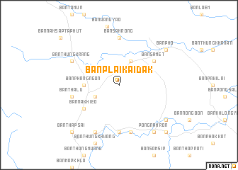
Ban Plai Kai Dak (Chanthaburi, Thailand)Ban Plai Kai Dak is a town in the Chanthaburi region of Thailand. An overview map of the region around Ban Plai Kai Dak is displayed below.
regional and 3d topo map of Ban Plai Kai Dak, Thailand ::
Ban Plai Kai Dak airports ::
The nearest airport is UTP - Rayong U Taphao Intl, located 148.1 km west of Ban Plai Kai Dak.
Other airports nearby include REP - Siem-reap Siem Reap (167.2 km east), BKK - Bangkok Intl (213.4 km north west), NAK - Nakhon Ratchasima Khorat (217.6 km north), Nearby towns ::
Ban Wang Kaphrae (4.1km south west) //
Ban Khlong Khot (4.1km north east) //
Ban Phangngon (5.4km west) //
Ban Na Khieo (6.6km south west) //
Ban Samet (6.6km north east) //
Ban Khlong Ta Khong (7.4km south) //
Ban Samrong (7.4km north) //
Ban Thalu (7.5km west) //
Ban Phaya Kamphut (7.6km south) //
Ban Samet Daeng (8.2km south west) //
Ban Thung Krang (8.1km north west) //
Pong Nam Ron (9.2km south east) //
Ban Na (9.2km south east) //
Ban Pho (9.1km north east) //
Ban Mai (9.1km south east) //
Ban Thap Sai (10.4km south west) //
Ban Khrua Wai (10.4km south east) //
[all distances 'as the bird flies' and approximate] 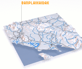 Places with similar names to Ban Plai Kai Dak, Thailand :: Disclaimer :: Information on this page comes without warranty of any kind |
||
|
Where is Ban Plai Kai Dak? Elevation and coordinates ::
Latitude (lat): 12°59'0"N Longitude (lon): 102°20'0"E
Elevation (approx.): 224m (map arrows pan, magnifying glasses zoom) |
||
|
Visiting Ban Plai Kai Dak? Hotel/Accommodation ::
Book a hotel in Ban Plai Kai Dak Travel Guide ::
Buy a travel guide for Thailand rental cars ::
car rental offers GPS waypoint ::
download a GPX waypoint (PoI) of Ban Plai Kai Dak for your GPS receiver
|
||