|
search place name
|
||
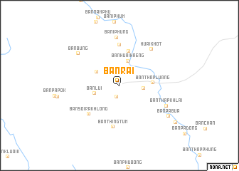
Ban Rai (Uthai Thani, Thailand)Ban Rai is a town in the Uthai Thani region of Thailand. An overview map of the region around Ban Rai is displayed below.
regional and 3d topo map of Ban Rai, Thailand ::
Ban Rai airports ::
The nearest airport is BKK - Bangkok Intl, located 174.5 km south east of Ban Rai.
Other airports nearby include PHS - Phitsanulok (204.9 km north east), Nearby towns ::
Ban Sanam (1.8km south) //
Ban Pha Thang (1) (2.3km north east) //
Ban Pha Thung (3.1km north east) //
Ban Phung Klan (3.7km east) //
Ban Huai Haeng (4.0km north) //
Ban Lui (3.9km west) //
Ban Nong Pru (4.0km north west) //
Ban Thap Luang (5.1km east) //
Ban Chao Wat (5.5km north) //
Ban I Phung (6.4km north) //
Ban Soi Rakhlong (6.4km south west) //
Ban Thing Tum (6.6km south) //
Ban I Phung (7.5km north) //
Huai Khot (7.5km north east) //
Ban Thap Khlai (7.8km south east) //
Ban Bung (8.0km north west) //
Ban Pa Bua (8.9km south east) //
Ban Pa Daeng (10.4km south east) //
[all distances 'as the bird flies' and approximate]  Places with similar names to Ban Rai, Thailand ::
Disclaimer :: Information on this page comes without warranty of any kind |
||
|
Where is Ban Rai? Elevation and coordinates ::
Latitude (lat): 15°4'57"N Longitude (lon): 99°31'16"E
Elevation (approx.): 157m (map arrows pan, magnifying glasses zoom) |
||
|
Visiting Ban Rai? Hotel/Accommodation ::
Book a hotel in Ban Rai Travel Guide ::
Buy a travel guide for Thailand rental cars ::
car rental offers GPS waypoint ::
download a GPX waypoint (PoI) of Ban Rai for your GPS receiver
|
||