|
search place name
|
||
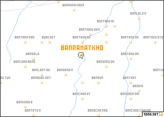
Ban Ramat Kho (Surin, Thailand)Ban Ramat Kho is a town in the Surin region of Thailand. An overview map of the region around Ban Ramat Kho is displayed below.
regional and 3d topo map of Ban Ramat Kho, Thailand ::
Ban Ramat Kho airports ::
The nearest airport is REP - Siem-reap Siem Reap, located 123.5 km south of Ban Ramat Kho.
Other airports nearby include PKZ - Pakse (206.9 km east), NAK - Nakhon Ratchasima Khorat (208.5 km west), Nearby towns ::
Ban Ta Wang (3.7km north) //
Ban Ka-ngok (3.7km north) //
Ban Khanun (3.7km north) //
Ban A Phon (5.2km south west) //
Ban Landa Tai (5.6km south) //
Ban Thai Doem (5.8km north) //
Ban Saruan (5.7km east) //
Ban Run (6.6km south east) //
Ban Nong Chong Long (6.5km north east) //
Ban Run (6.6km south east) //
Ban Sangkae (7.7km north east) //
Bua Chet (8.1km north west) //
Ban Ta Nuai (9.2km north east) //
Ban Bok (10.3km north east) //
[all distances 'as the bird flies' and approximate] 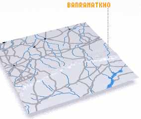 Places with similar names to Ban Ramat Kho, Thailand :: Disclaimer :: Information on this page comes without warranty of any kind |
||
|
Where is Ban Ramat Kho? Elevation and coordinates ::
Latitude (lat): 14°31'0"N Longitude (lon): 103°58'0"E
Elevation (approx.): 183m (map arrows pan, magnifying glasses zoom) |
||
|
Visiting Ban Ramat Kho? Hotel/Accommodation ::
Book a hotel in Ban Ramat Kho Travel Guide ::
Buy a travel guide for Thailand rental cars ::
car rental offers GPS waypoint ::
download a GPX waypoint (PoI) of Ban Ramat Kho for your GPS receiver
|
||