|
search place name
|
||
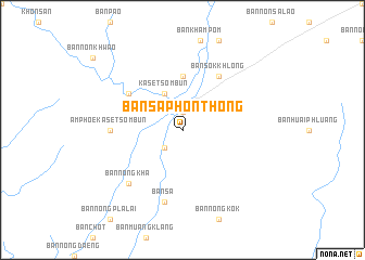
Ban Sa Phon Thong (Chaiyaphum, Thailand)Ban Sa Phon Thong is a town in the Chaiyaphum region of Thailand. An overview map of the region around Ban Sa Phon Thong is displayed below.
regional and 3d topo map of Ban Sa Phon Thong, Thailand ::
Ban Sa Phon Thong airports ::
The nearest airport is LOE - Loei, located 134.2 km north of Ban Sa Phon Thong.
Other airports nearby include NAK - Nakhon Ratchasima Khorat (146.1 km south), UTH - Udon Thani (153.2 km north east), PHS - Phitsanulok (189.6 km west), VTE - Vientiane Wattay Intl (202.6 km north), Nearby towns ::
Ban Pho (1.9km north) //
Ban That Chom Si (2.6km south west) //
Kaset Sombun (4.1km north west) //
Ban Non Makhang (5.6km north) //
Ban Sok Khlong (6.6km north east) //
Ban Kut Lo (6.5km north west) //
Amphoe Kaset Sombun (7.1km west) //
Ban Sa (7.6km south) //
Ban Nong Kha (7.7km south west) //
[all distances 'as the bird flies' and approximate] 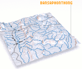 Places with similar names to Ban Sa Phon Thong, Thailand ::
// Ban Siphônthong (LA)
Disclaimer :: Information on this page comes without warranty of any kind |
||
|
Where is Ban Sa Phon Thong? Elevation and coordinates ::
Latitude (lat): 16°15'0"N Longitude (lon): 101°58'0"E
Elevation (approx.): 237m (map arrows pan, magnifying glasses zoom) |
||
|
Visiting Ban Sa Phon Thong? Hotel/Accommodation ::
Book a hotel in Ban Sa Phon Thong Travel Guide ::
Buy a travel guide for Thailand rental cars ::
car rental offers GPS waypoint ::
download a GPX waypoint (PoI) of Ban Sa Phon Thong for your GPS receiver
|
||