|
search place name
|
||
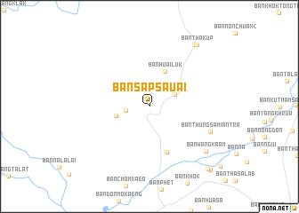
Ban Sap Sa-uai (Chaiyaphum, Thailand)Ban Sap Sa-uai is a town in the Chaiyaphum region of Thailand. An overview map of the region around Ban Sap Sa-uai is displayed below.
regional and 3d topo map of Ban Sap Sa-uai, Thailand ::
Ban Sap Sa-uai airports ::
The nearest airport is NAK - Nakhon Ratchasima Khorat, located 81.1 km south east of Ban Sap Sa-uai.
Other airports nearby include PHS - Phitsanulok (201.8 km north west), LOE - Loei (209.0 km north), BKK - Bangkok Intl (214.4 km south west), UTH - Udon Thani (235.6 km north east), Nearby towns ::
Ban Nong Takai (2.9km west) //
Ban Khuan Lan (3.4km north east) //
Ban Taluk Lan (4.1km west) //
Ban Huai Luk (4.8km north east) //
Bamnet Narong (6.1km south) //
Ban Thung Samiantra (8.0km south east) //
Ban Wang Kaam (8.8km south east) //
Ban Huai Hin Lat (9.5km north east) //
Ban Tha Kup (9.7km north east) //
Ban Tan (10.6km south east) //
Ban Nong Luk Chang (10.9km south east) //
Ban Krathum Phra (11.4km south east) //
[all distances 'as the bird flies' and approximate]  Places with similar names to Ban Sap Sa-uai, Thailand ::
// Ban Sop Sa (TH)
// Ban Sop Sa (TH)
// Ban Sop Sai (TH)
// Ban Sop Sai (TH)
// Ban Sop Soi (TH)
// Ban Sôpsai (LA)
// Ban Sôpso (LA)
Disclaimer :: Information on this page comes without warranty of any kind |
||
|
Where is Ban Sap Sa-uai? Elevation and coordinates ::
Latitude (lat): 15°33'3"N Longitude (lon): 101°40'12"E
Elevation (approx.): 230m (map arrows pan, magnifying glasses zoom) |
||
|
Visiting Ban Sap Sa-uai? Hotel/Accommodation ::
Book a hotel in Ban Sap Sa-uai Travel Guide ::
Buy a travel guide for Thailand rental cars ::
car rental offers GPS waypoint ::
download a GPX waypoint (PoI) of Ban Sap Sa-uai for your GPS receiver
|
||