|
search place name
|
||
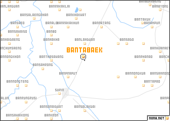
Ban Tabaek (Surin, Thailand)Ban Tabaek is a town in the Surin region of Thailand. An overview map of the region around Ban Tabaek is displayed below.
regional and 3d topo map of Ban Tabaek, Thailand ::
Ban Tabaek airports ::
The nearest airport is NAK - Nakhon Ratchasima Khorat, located 156.5 km west of Ban Tabaek.
Other airports nearby include REP - Siem-reap Siem Reap (173.0 km south), ZVK - Savannakhet (221.1 km north east), Nearby towns ::
Ban Lamduan (3.7km north) //
Ban Pra Put (5.2km south west) //
Ban Khi Lek (5.2km south west) //
Ban Tha Sawang (7.2km west) //
Ban Makha (8.1km north west) //
Ban Hua Raet (8.1km south east) //
Ban Raka Khun (8.2km north west) //
Ban Chok (8.1km north east) //
Ban Na Tang (8.2km north east) //
Ban Bo (9.1km north west) //
Surin (9.2km south west) //
Ban Alo (10.3km north west) //
[all distances 'as the bird flies' and approximate] 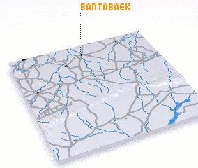 Places with similar names to Ban Tabaek, Thailand ::
// Ban Tabaek (TH)
// Ban Tabaek (TH)
// Ban Tabaek (TH)
// Ban Tabaek (TH)
// Ban Ti Buk (TH)
// Bantebe-Eke (CD)
// Buntubuku (ID)
// Boundou Boki (SN)
// Bantabagué (GN)
// Bontebok (NL)
Disclaimer :: Information on this page comes without warranty of any kind |
||
|
Where is Ban Tabaek? Elevation and coordinates ::
Latitude (lat): 14°57'0"N Longitude (lon): 103°32'0"E
Elevation (approx.): 153m (map arrows pan, magnifying glasses zoom) |
||
|
Visiting Ban Tabaek? Hotel/Accommodation ::
Book a hotel in Ban Tabaek Travel Guide ::
Buy a travel guide for Thailand rental cars ::
car rental offers GPS waypoint ::
download a GPX waypoint (PoI) of Ban Tabaek for your GPS receiver
|
||