|
search place name
|
||
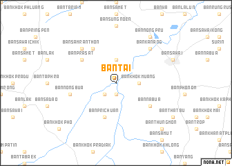
Ban Ta I (Buriram, Thailand)Ban Ta I is a town in the Buriram region of Thailand. An overview map of the region around Ban Ta I is displayed below.
regional and 3d topo map of Ban Ta I, Thailand ::
Ban Ta I airports ::
The nearest airport is NAK - Nakhon Ratchasima Khorat, located 129.2 km west of Ban Ta I.
Other airports nearby include REP - Siem-reap Siem Reap (161.2 km south), ZVK - Savannakhet (254.6 km north east), Nearby towns ::
Ban Khok Run (1.9km south) //
Ban Samet (2.6km south west) //
Ban Khok Muang (3.6km east) //
Ban Nong Bua Thanon (3.7km north) //
Ban Pri Chuan (5.8km south) //
Ban Prasat (6.5km north west) //
Ban Na Bua (6.5km south east) //
Ban Raka (6.6km north west) //
Ban Nong Bua (7.4km west) //
Ban Kanang (7.7km north east) //
Ban Samran Thon (7.7km north west) //
Ban Nong Pru (9.2km north east) //
Ban Thung Mon (10.3km south east) //
[all distances 'as the bird flies' and approximate] 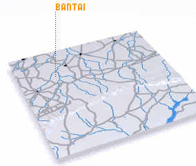 Places with similar names to Ban Ta I, Thailand ::
Disclaimer :: Information on this page comes without warranty of any kind |
||
|
Where is Ban Ta I? Elevation and coordinates ::
Latitude (lat): 14°46'0"N Longitude (lon): 103°16'0"E
Elevation (approx.): 144m (map arrows pan, magnifying glasses zoom) |
||
|
Visiting Ban Ta I? Hotel/Accommodation ::
Book a hotel in Ban Ta I Travel Guide ::
Buy a travel guide for Thailand rental cars ::
car rental offers GPS waypoint ::
download a GPX waypoint (PoI) of Ban Ta I for your GPS receiver
|
||