|
search place name
|
||
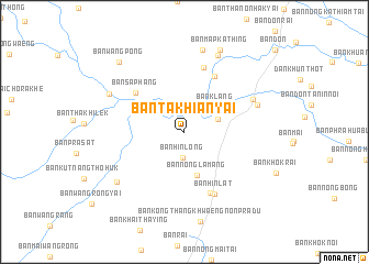
Ban Takhian Yai (Nakhon Ratchasima, Thailand)Ban Takhian Yai is a town in the Nakhon Ratchasima region of Thailand. An overview map of the region around Ban Takhian Yai is displayed below.
regional and 3d topo map of Ban Takhian Yai, Thailand ::
Ban Takhian Yai airports ::
The nearest airport is NAK - Nakhon Ratchasima Khorat, located 47.6 km south east of Ban Takhian Yai.
Other airports nearby include BKK - Bangkok Intl (181.4 km south west), PHS - Phitsanulok (235.5 km north west), Nearby towns ::
Ban Hin Long (2.6km south) //
Ban Kut Muang (3.5km east) //
Ban Klang (4.0km north east) //
Ban Nong Lamang (4.6km south) //
Ban Nong Phang Phot (5.0km north west) //
Ban Sa Phang (6.2km north west) //
Ban Non Sadao (6.4km north east) //
Ban Hin Lat (6.7km south east) //
Ban Don Ta Nin (6.8km north) //
Ban Hin Lat (7.0km south east) //
Ban Chan (7.5km north east) //
Ban Khok Rak (7.6km east) //
Ban Phan Chana (8.4km north east) //
Ban Kao (8.5km north) //
Ban Rai Noi (8.3km north west) //
Ban Hin Dat (8.4km south west) //
Ban Map Kathing (9.0km north east) //
Ban Wang Pong (9.5km north west) //
[all distances 'as the bird flies' and approximate] 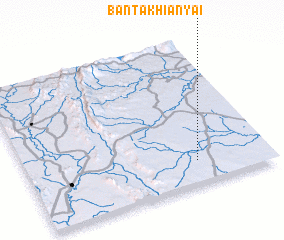 Places with similar names to Ban Takhian Yai, Thailand ::
// Ban Takhian Yao (TH)
Disclaimer :: Information on this page comes without warranty of any kind |
||
|
Where is Ban Takhian Yai? Elevation and coordinates ::
Latitude (lat): 15°9'31"N Longitude (lon): 101°42'1"E
Elevation (approx.): 224m (map arrows pan, magnifying glasses zoom) |
||
|
Visiting Ban Takhian Yai? Hotel/Accommodation ::
Book a hotel in Ban Takhian Yai Travel Guide ::
Buy a travel guide for Thailand rental cars ::
car rental offers GPS waypoint ::
download a GPX waypoint (PoI) of Ban Takhian Yai for your GPS receiver
|
||