|
search place name
|
||
Ban Tako (Nakhon Ratchasima, Thailand)Ban Tako is a town in the Nakhon Ratchasima region of Thailand. An overview map of the region around Ban Tako is displayed below.
regional and 3d topo map of Ban Tako, Thailand ::

Ban Tako airports ::
The nearest airport is NAK - Nakhon Ratchasima Khorat, located 11.4 km south of Ban Tako.
Other airports nearby include BKK - Bangkok Intl (199.0 km south west), REP - Siem-reap Siem Reap (261.6 km south east), PHS - Phitsanulok (271.0 km north west), Nearby towns ::
Ban Kat Lin (0.0km north) //
Ban Kluai (1.9km south) //
Ban Hua Chang (1.9km north) //
Ban Bu Kathin (1.8km west) //
Ban Nong Ya Rak (2.6km north east) //
Ban Bung Tako (3.6km west) //
Ban Takhlong Kao (1) (3.7km south) //
Ban Fai (1) (3.6km east) //
Ban Khwao (3.7km north) //
Ban Phon Krang (1) (4.0km south west) //
Ban Mun Wai (4.0km south east) //
Ban Tang Ta (1) (4.1km south east) //
Ban Lam Phong (4.1km north east) //
Ban Kok (5.2km south west) //
Ban Nong Krathum (5.2km south east) //
Ban Nong Ya Ngam (1) (5.2km south east) //
Ban Krut (5.4km east) //
Ban Nong Krat (5.6km north) //
Ban Kamthuat (5.6km south) //
Ban Khon Chum (5.6km south) //
Ban Kasieo (5.8km north) //
Ban Nong U Lok (5.8km north) //
Ban Liap (5.8km south) //
Ban Pae (5.8km south) //
Ban Song (6.6km south west) //
Ban Nong Ya Rak (6.6km south west) //
Ban Krasieo (6.6km south west) //
Ban Khok Phai (1) (6.5km south east) //
Ban Mun Wai (6.6km south west) //
[all distances 'as the bird flies' and approximate] 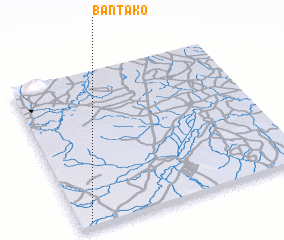 Places with similar names to Ban Tako, Thailand ::
Disclaimer :: Information on this page comes without warranty of any kind |
||
|
Where is Ban Tako? Elevation and coordinates ::
Latitude (lat): 15°2'0"N Longitude (lon): 102°3'0"E
Elevation (approx.): 183m (map arrows pan, magnifying glasses zoom) |
||
|
Visiting Ban Tako? Hotel/Accommodation ::
Book a hotel in Ban Tako Travel Guide ::
Buy a travel guide for Thailand rental cars ::
car rental offers GPS waypoint ::
download a GPX waypoint (PoI) of Ban Tako for your GPS receiver
|
||