|
search place name
|
||
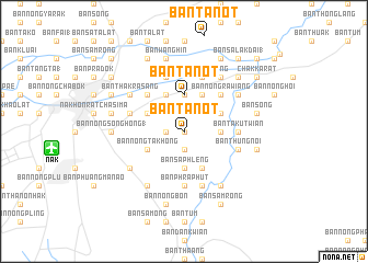
Ban Tanot (Nakhon Ratchasima, Thailand)Ban Tanot is a town in the Nakhon Ratchasima region of Thailand. An overview map of the region around Ban Tanot is displayed below.
regional and 3d topo map of Ban Tanot, Thailand ::
Ban Tanot airports ::
The nearest airport is NAK - Nakhon Ratchasima Khorat, located 13.2 km west of Ban Tanot.
Other airports nearby include BKK - Bangkok Intl (206.6 km south west), REP - Siem-reap Siem Reap (243.6 km south east), PHS - Phitsanulok (288.9 km north west), Nearby towns ::
Ban Nong Muang (0.0km north) //
Ban Thap Chang (1.9km south) //
Ban Cha-om (1.9km south) //
Ban Map Makha (1.8km west) //
Ban Bu Ta Non (3.6km east) //
Ban Chang Kho (3.6km east) //
Ban Sa Phleng (3.7km south) //
Ban Ruang (3.7km north) //
Ban Maroeng Yai (3.7km north) //
Ban Maroeng Noi (3.7km north) //
Ban Phanao (3.7km north) //
Ban Tanot (3.7km north) //
Ban Dan Thong Lang (3.7km north) //
Ban Som (3.7km north) //
Ban Kan Phom (3.7km north) //
Ban Nong Sai (3.7km north) //
Ban Dan Kata (4.0km north east) //
Ban Khwao (4.0km north east) //
Ban Nong Kham (4.1km south east) //
Ban Nong Khon (4.1km north west) //
Ban Nam Lai (4.1km north east) //
Ban Khok (4.1km north west) //
Ban Nong Ta Khong (4.0km south west) //
Ban Saraphi (4.0km north west) //
Ban Nong Rawiang (5.2km north east) //
Ban Phra (5.2km north west) //
Ban Takut Wian (5.4km east) //
Ban Phra Phut (5.6km south) //
Ban Nong Hoi (5.6km south) //
[all distances 'as the bird flies' and approximate]  Places with similar names to Ban Tanot, Thailand ::
// Ban Dan Tae (TH)
// Ban Don Du (TH)
// Ban Don Du (TH)
// Ban Don Du (TH)
// Ban Don Du (TH)
// Ban Don Du (TH)
// Ban Don Du (TH)
// Ban Don Du (TH)
// Ban Don Dua (TH)
// Ban Don Dua (TH)
Disclaimer :: Information on this page comes without warranty of any kind |
||
|
Where is Ban Tanot? Elevation and coordinates ::
Latitude (lat): 14°57'0"N Longitude (lon): 102°12'0"E
Elevation (approx.): 183m (map arrows pan, magnifying glasses zoom) |
||
|
Visiting Ban Tanot? Hotel/Accommodation ::
Book a hotel in Ban Tanot Travel Guide ::
Buy a travel guide for Thailand rental cars ::
car rental offers GPS waypoint ::
download a GPX waypoint (PoI) of Ban Tanot for your GPS receiver
|
||