|
search place name
|
||
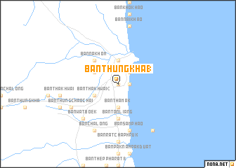
Ban Thung Kha (1) (Nakhon Si Thammarat, Thailand)Ban Thung Kha (1) is a town in the Nakhon Si Thammarat region of Thailand. An overview map of the region around Ban Thung Kha (1) is displayed below.
regional and 3d topo map of Ban Thung Kha (1), Thailand ::
Ban Thung Kha (1) airports ::
The nearest airport is NST - Nakhon Si Thammarat Cha Ian, located 55.1 km south of Ban Thung Kha (1).
Other airports nearby include TST - Trang (164.2 km south), HKT - Phuket Intl (198.2 km south west), Nearby towns ::
Ban Chom Phibun (0.0km north) //
Ban Thepha (1.8km east) //
Ban Plai Thon (2.6km north east) //
Amphoe Sichon (3.7km north) //
Ban Tha Mak (3.7km south) //
Ban Khao Kiat (4.1km north west) //
Ban Tha Khwai (2) (4.1km south west) //
Ban Na Khom (5.2km north west) //
Ban Ton Liang (5.6km south) //
Ban Samphao (7.6km south) //
Ban Wat Boek (7.8km south west) //
Ban Chalong (8.3km south west) //
Ban Thung Chao Chai (8.2km south west) //
Ban Nam Dam (9.2km south east) //
[all distances 'as the bird flies' and approximate]  Places with similar names to Ban Thung Kha (1), Thailand ::
// Ban Thung Kha (1) (TH)
Disclaimer :: Information on this page comes without warranty of any kind |
||
|
Where is Ban Thung Kha (1)? Elevation and coordinates ::
Latitude (lat): 8°58'0"N Longitude (lon): 99°54'0"E
Elevation (approx.): 7m (map arrows pan, magnifying glasses zoom) |
||
|
Visiting Ban Thung Kha (1)? Hotel/Accommodation ::
Book a hotel in Ban Thung Kha (1) Travel Guide ::
Buy a travel guide for Thailand rental cars ::
car rental offers GPS waypoint ::
download a GPX waypoint (PoI) of Ban Thung Kha (1) for your GPS receiver
|
||