|
search place name
|
||
Ban Wan Dao (Ratchaburi, Thailand)Ban Wan Dao is a town in the Ratchaburi region of Thailand. An overview map of the region around Ban Wan Dao is displayed below.
regional and 3d topo map of Ban Wan Dao, Thailand ::

Ban Wan Dao airports ::
The nearest airport is HHQ - Prachuap Khiri Khan Hua Hin, located 79.7 km south of Ban Wan Dao.
Other airports nearby include BKK - Bangkok Intl (102.9 km north east), UTP - Rayong U Taphao Intl (145.6 km south east), MGZ - Myeik (167.1 km south west), Nearby towns ::
Ban Khok Ka Don (0.0km north) //
Ban Nong Khang (0.0km north) //
Ban Ton Mamuang (0.0km north) //
Ban Khao Lao (1.8km west) //
Ban Nam Phu (1.8km west) //
Ban Huai Rong (1.9km south) //
Ban Pak Rang (1.8km east) //
Ban Dong Tan (2.6km north west) //
Ban Don Muang (2.6km north west) //
Ban Sammachot (1) (2.6km north east) //
Ban Rua (2.6km north east) //
Ban Phraek Nam Daeng (2.6km south east) //
Ban Wang Katha (3.6km west) //
Ban Huai Rong (3.6km west) //
Pak Tho (3.7km north) //
Ban Nong Suang (3.7km north) //
Ban Nong Yai (3.6km east) //
Ban Bang Phi Lok (3.6km east) //
Ban Khok Phra (4.1km north west) //
Ban Nong Lat (4.1km north west) //
Ban Huai Noi (4.1km south west) //
Ban Khok Wihan (4.1km north east) //
Ban Rong Na (4.1km north east) //
Ban Thalu Kaeo (4.1km north east) //
Ban Khlong Khot (4.1km south east) //
Ban Chet Hap (5.2km south west) //
Ban Nong Kapho (5.2km south west) //
Ban Don Kra (5.2km north west) //
Ban Sala Daeng (5.2km north east) //
[all distances 'as the bird flies' and approximate] 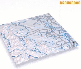 Places with similar names to Ban Wan Dao, Thailand :: Disclaimer :: Information on this page comes without warranty of any kind |
||
|
Where is Ban Wan Dao? Elevation and coordinates ::
Latitude (lat): 13°21'0"N Longitude (lon): 99°51'0"E
Elevation (approx.): 4m (map arrows pan, magnifying glasses zoom) |
||
|
Visiting Ban Wan Dao? Hotel/Accommodation ::
Book a hotel in Ban Wan Dao Travel Guide ::
Buy a travel guide for Thailand rental cars ::
car rental offers GPS waypoint ::
download a GPX waypoint (PoI) of Ban Wan Dao for your GPS receiver
|
||