|
search place name
|
||
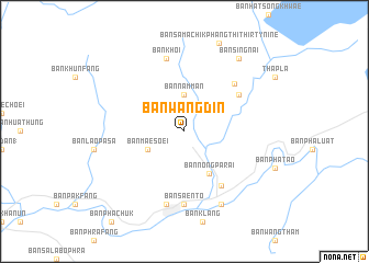
Ban Wang Din (Uttaradit, Thailand)Ban Wang Din is a town in the Uttaradit region of Thailand. An overview map of the region around Ban Wang Din is displayed below.
regional and 3d topo map of Ban Wang Din, Thailand ::
Ban Wang Din airports ::
The nearest airport is PRH - Phrae, located 46.4 km north of Ban Wang Din.
Other airports nearby include LPT - Lampang (103.2 km north west), PHS - Phitsanulok (105.2 km south), LOE - Loei (154.4 km east), Nearby towns ::
Ban Nam Man (3.7km north) //
Ban Mae Soei (4.0km south west) //
Ban Nong Pa Rai (4.9km south east) //
Ban Hat Ngiu (6.6km south east) //
Ban Nam Sing (6.5km north east) //
Ban Samachik Phang Thi One (6.8km north east) //
Ban Saen To (7.4km south) //
Ban Dan (7.6km south) //
Ban Khoi (7.6km north) //
Ban Nong Hia (8.2km south east) //
Ban Sing Nai (9.1km north east) //
[all distances 'as the bird flies' and approximate]  Places with similar names to Ban Wang Din, Thailand ::
// Ban Na Wong Duan (TH)
// Ban Wang Din (TH)
// Ban Wang Din (TH)
// Ban Wang Din (TH)
// Ban Wang Duan (TH)
// Ban Wang Duan (TH)
// Ban Wang Duan (TH)
// Ban Wang Tan (TH)
// Ban Wang Ton (TH)
Disclaimer :: Information on this page comes without warranty of any kind |
||
|
Where is Ban Wang Din? Elevation and coordinates ::
Latitude (lat): 17°44'0"N Longitude (lon): 100°18'0"E
Elevation (approx.): 85m (map arrows pan, magnifying glasses zoom) |
||
|
Visiting Ban Wang Din? Hotel/Accommodation ::
Book a hotel in Ban Wang Din Travel Guide ::
Buy a travel guide for Thailand rental cars ::
car rental offers GPS waypoint ::
download a GPX waypoint (PoI) of Ban Wang Din for your GPS receiver
|
||