|
search place name
|
||
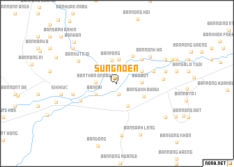
Sung Noen (Nakhon Ratchasima, Thailand)Sung Noen is a town in the Nakhon Ratchasima region of Thailand. An overview map of the region around Sung Noen is displayed below.
regional and 3d topo map of Sung Noen, Thailand ::
Sung Noen airports ::
The nearest airport is NAK - Nakhon Ratchasima Khorat, located 28.8 km east of Sung Noen.
Other airports nearby include BKK - Bangkok Intl (169.9 km south west), PHS - Phitsanulok (265.5 km north west), REP - Siem-reap Siem Reap (271.4 km south east), Nearby towns ::
Ban Maklua Kao (1.8km south) //
Ban Hin Tang (2.0km north) //
Ban Khlong Khwang (2.5km north west) //
Ban Kok Kok (2.9km north east) //
Ban Thanon Na Di (3.3km west) //
Ban Pong (3.8km north) //
Ban Khok Sung (3.7km south west) //
Ban Rai (3.7km south west) //
Ban Thale (3.8km north) //
Ban Hua Sa (3.8km north west) //
Ban Don Manao (3.8km north west) //
Ban Bot (3.9km east) //
Ban Pak Thang (4.0km south east) //
Ban Bung Khi Lek (4.2km north east) //
Ban Na Ta Khrok (4.4km north east) //
Ban Mai (4.4km north east) //
Ban Sukhawadi (4.7km south east) //
Ban Khok Makok (5.0km north east) //
Ban Don (5.5km north east) //
Ban That Tha (6.0km east) //
Ban Maklua Mai (6.3km south west) //
Ban Non Kha (6.6km north east) //
Ban Kut Noi (7.0km north west) //
Ban Bung Lamyai (7.1km west) //
Ban Kut Chik (7.2km east) //
Ban Kut Khlon (7.7km east) //
Ban Non Na (8.3km south) //
Ban Ko (8.4km north east) //
Ban Khok Makak (8.4km north east) //
[all distances 'as the bird flies' and approximate]  Places with similar names to Sung Noen, Thailand ::
// Singnen (MM)
// Zanganān (IQ)
// Sangouanian (GN)
// Sankiniana (GN)
// Sangnon (KR)
// Senkinen (GF)
// Sanganian (ML)
// Sanguénéna (ML)
// Senganine (MZ)
// Sengonan (ID)
Disclaimer :: Information on this page comes without warranty of any kind |
||
|
Where is Sung Noen? Elevation and coordinates ::
Latitude (lat): 14°53'56"N Longitude (lon): 101°48'50"E
Elevation (approx.): 217m (map arrows pan, magnifying glasses zoom) |
||
|
Visiting Sung Noen? Hotel/Accommodation ::
Book a hotel in Sung Noen Travel Guide ::
Buy a travel guide for Thailand rental cars ::
car rental offers GPS waypoint ::
download a GPX waypoint (PoI) of Sung Noen for your GPS receiver
|
||